Collections Item Detail
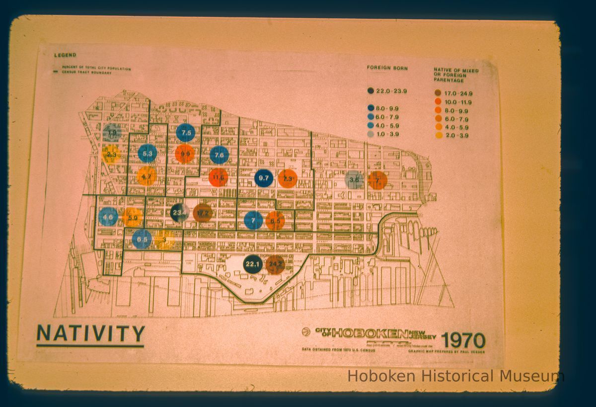
Graphic map by Paul Veeder showing "nativity" analysis of neighborhoods based on 1970 US census data and using the City of Hoboken map by mayo lynch and associates revised in 1972 for hoboken model cities
Photograph
Graphic map by Paul Veeder showing "nativity" analysis of neighborhoods based on 1970 US census data and using the City of Hoboken map by mayo lynch and associates revised in 1972 for hoboken model cities.
2012.027.0358
Color Mounted Transparency
1.5:1
Hoboken
2012.027
Veeder, Paul L.
Gift
Gift of Paul Veeder.
Veeder, Paul L.
Photographer
Apr 1975
35mm Kodachrome slide mount marked FEB75N6 by processor
Label
Slide mount
[No Inscription on this slide]
In Artist's HandMarker


