Collections Item Detail
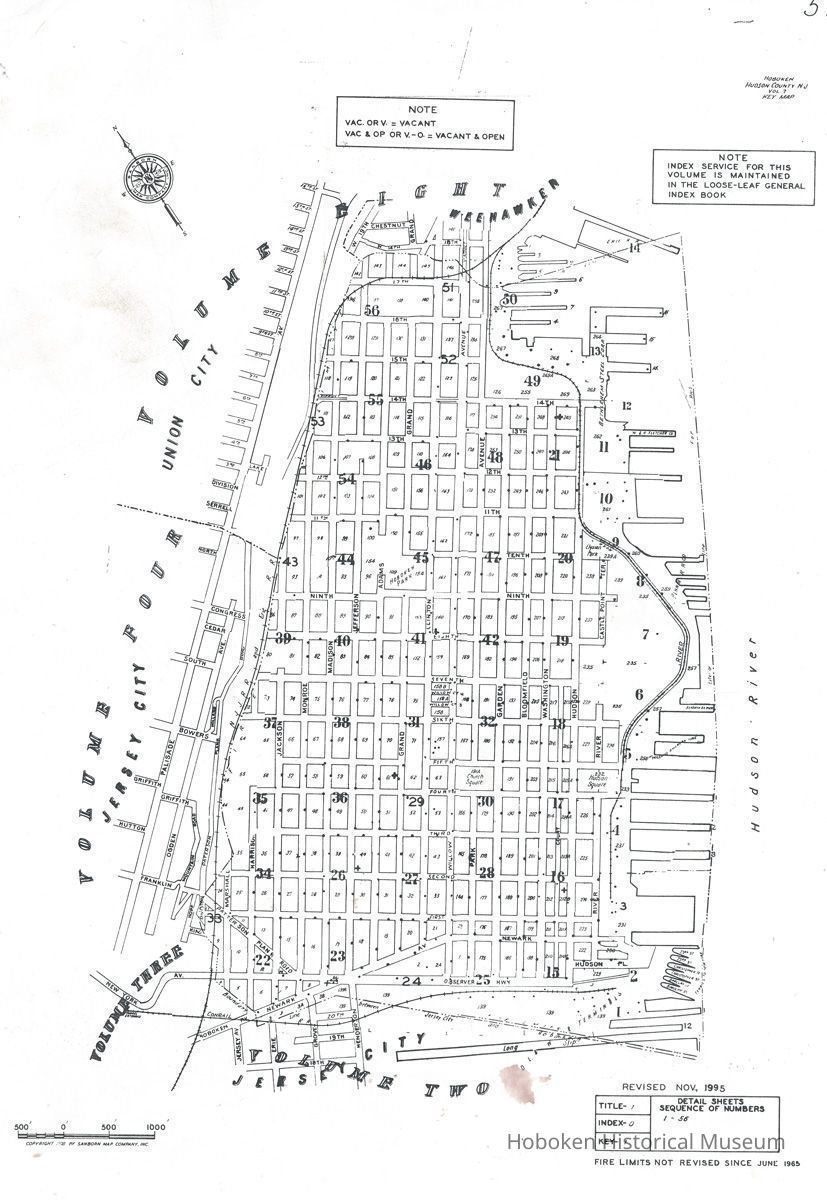
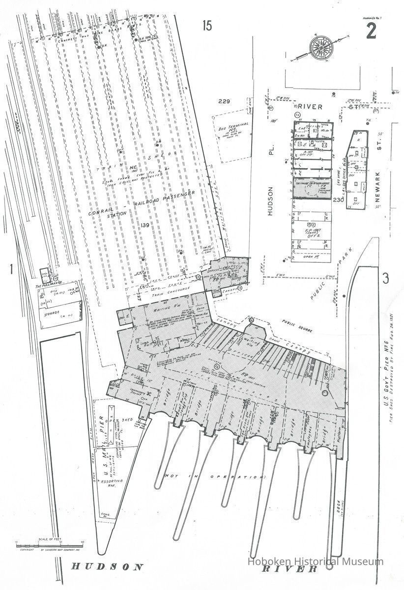
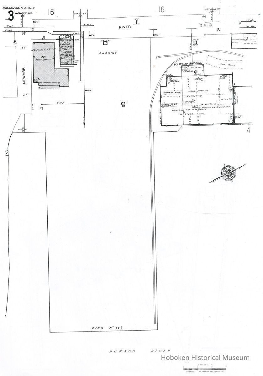
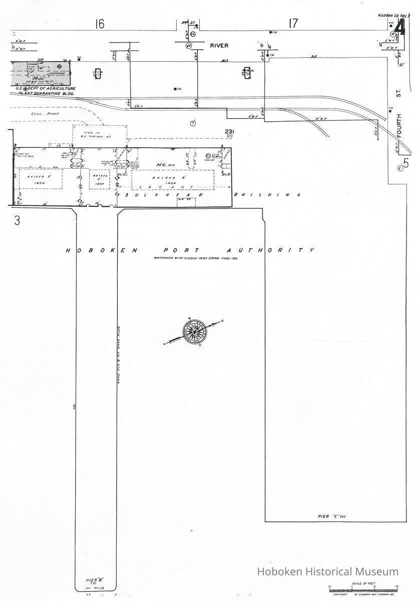
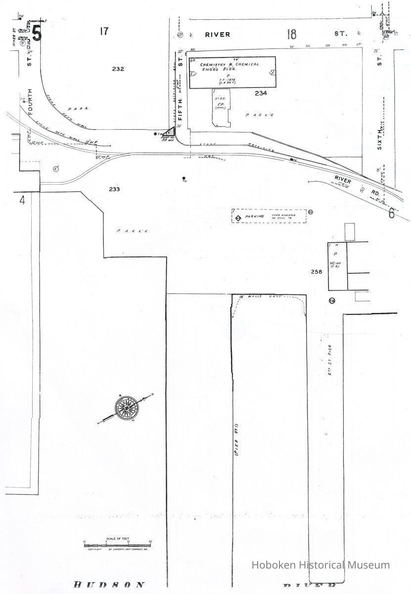
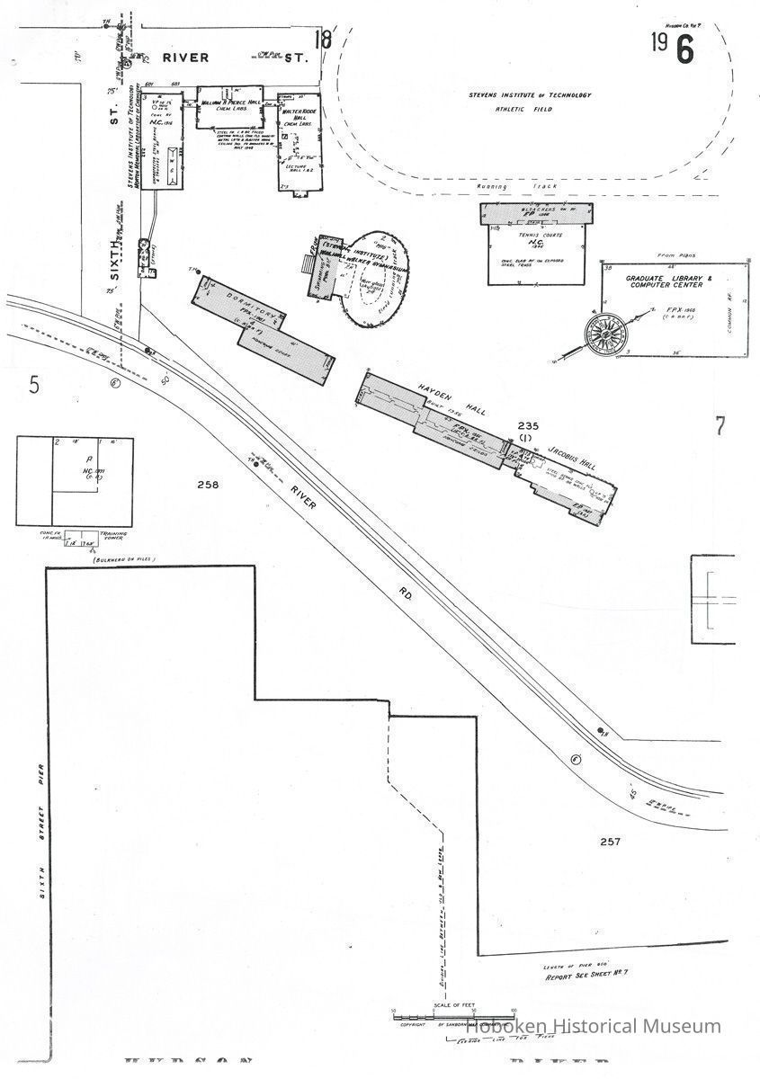
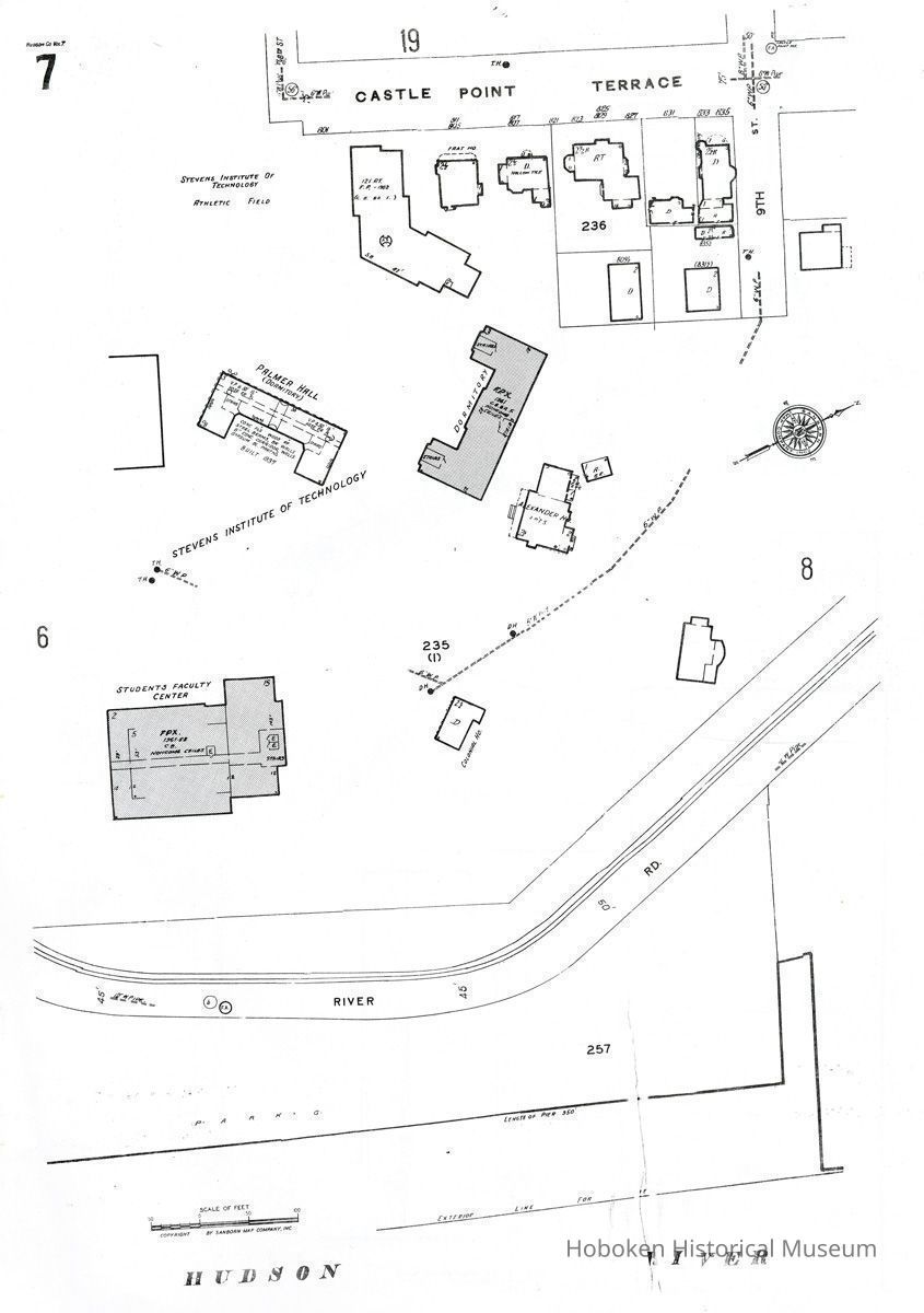
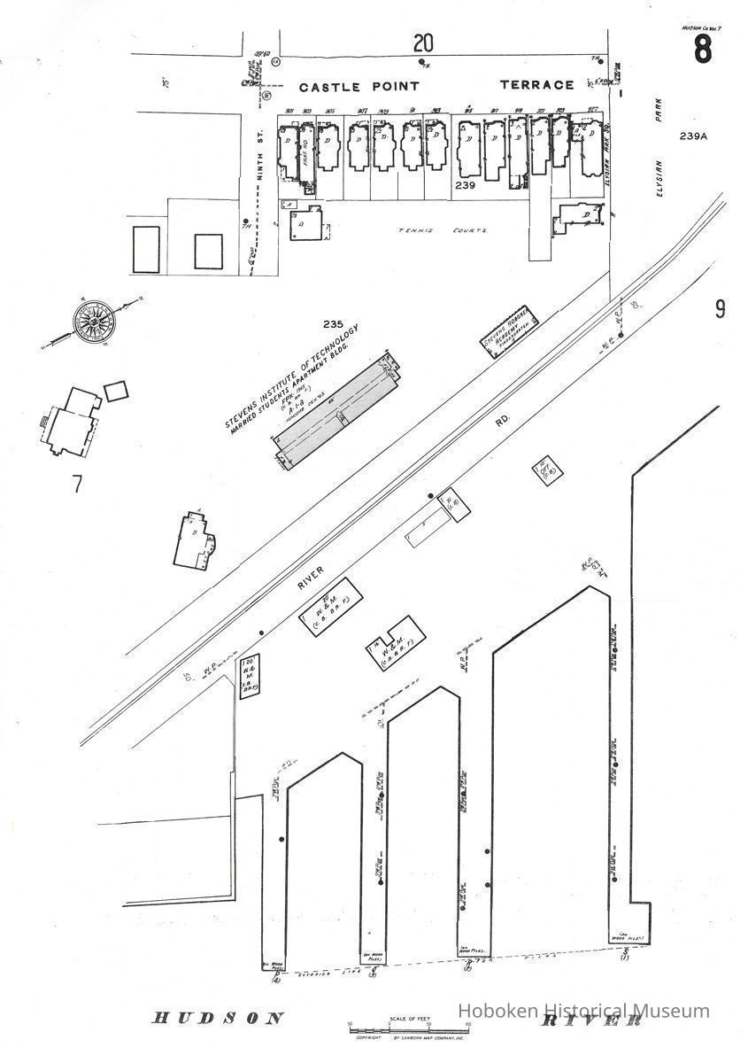
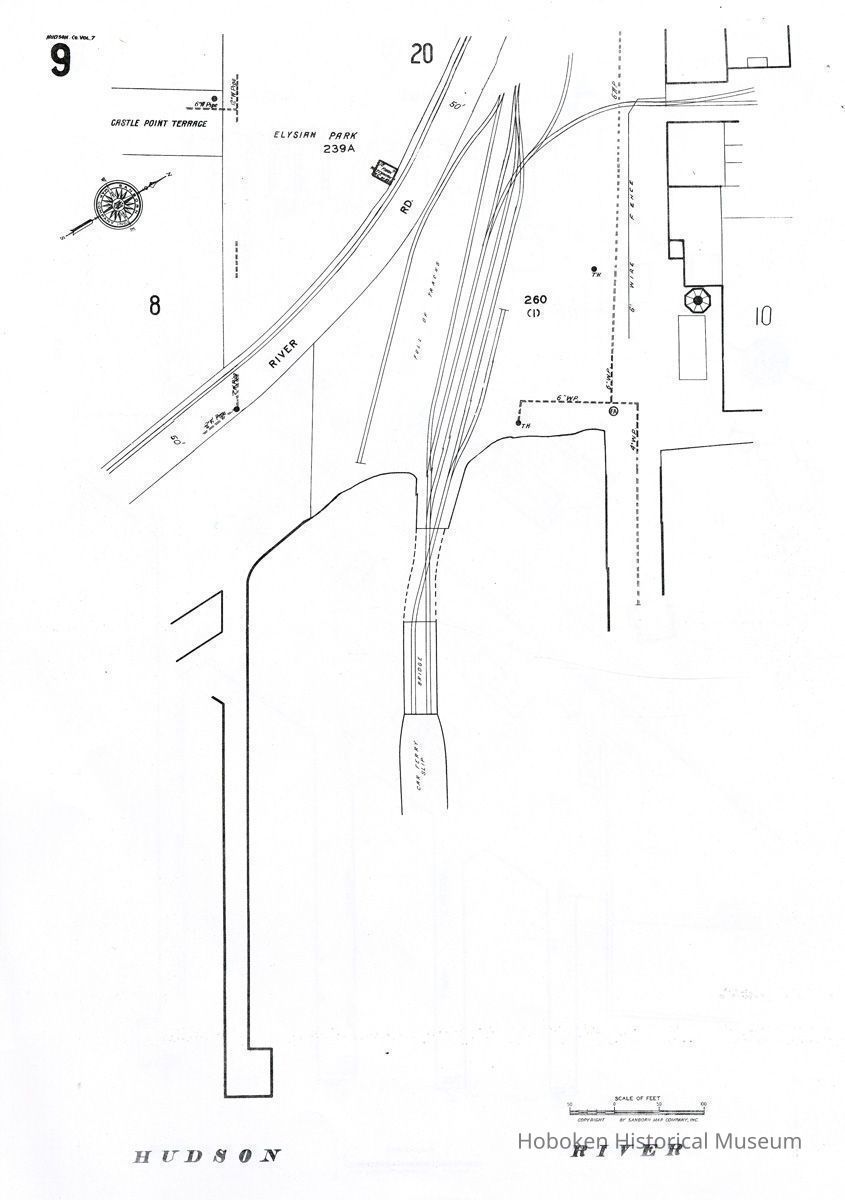
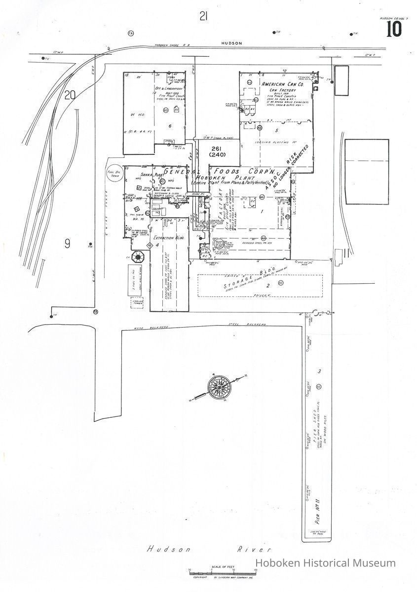
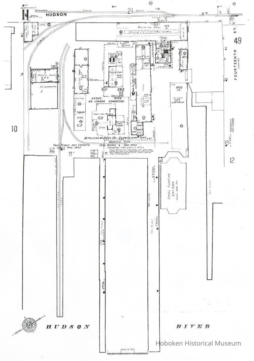
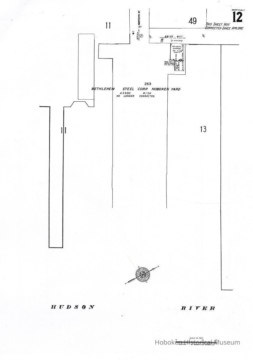
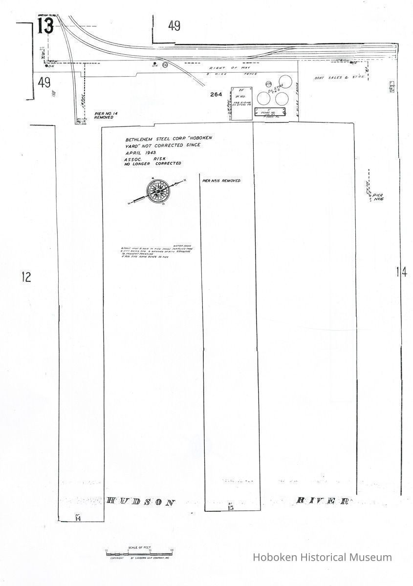
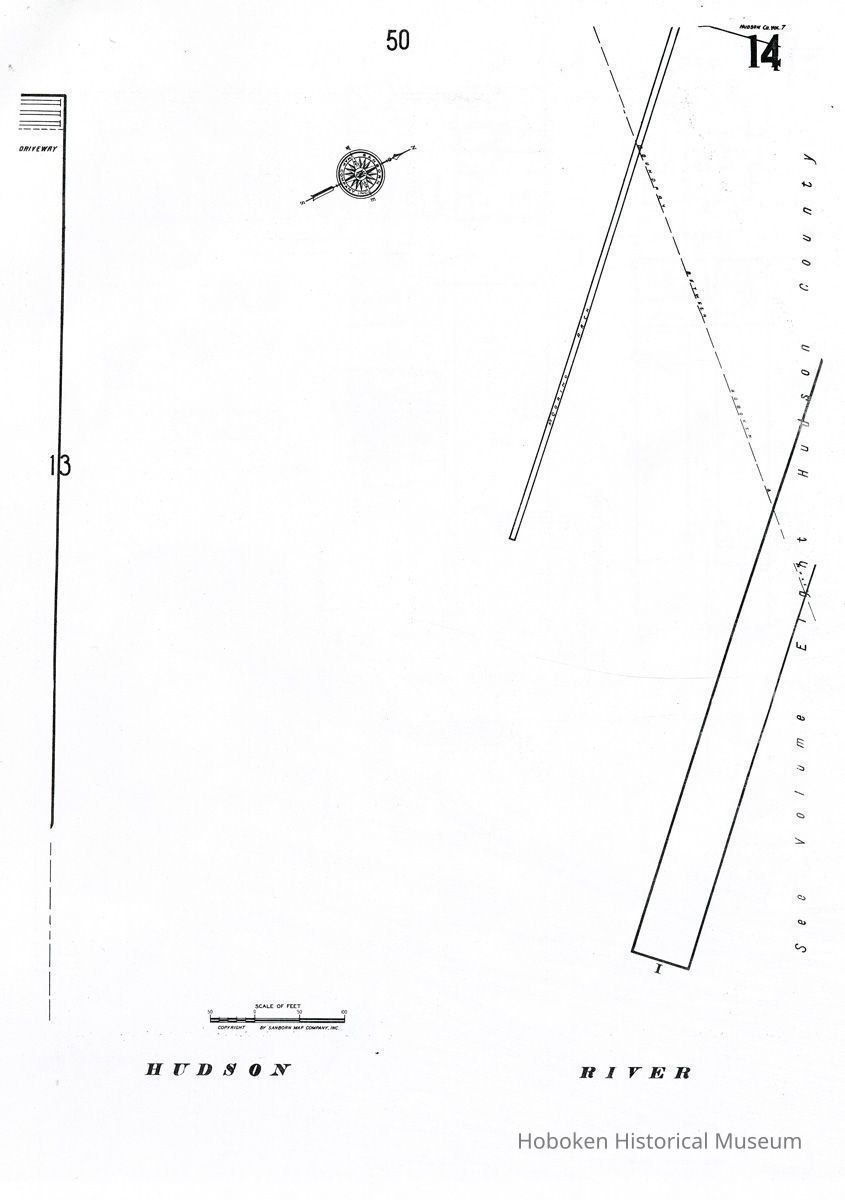
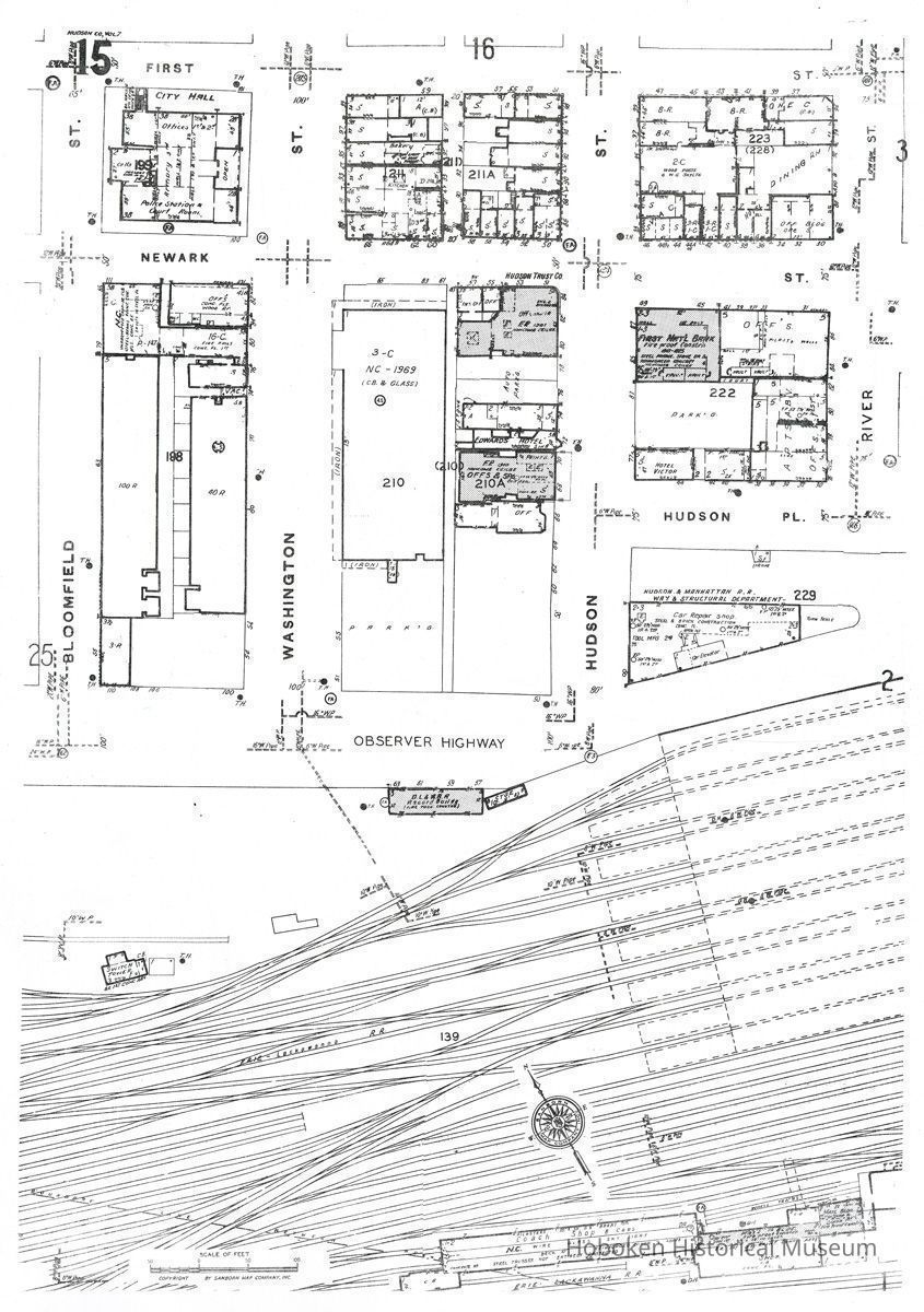
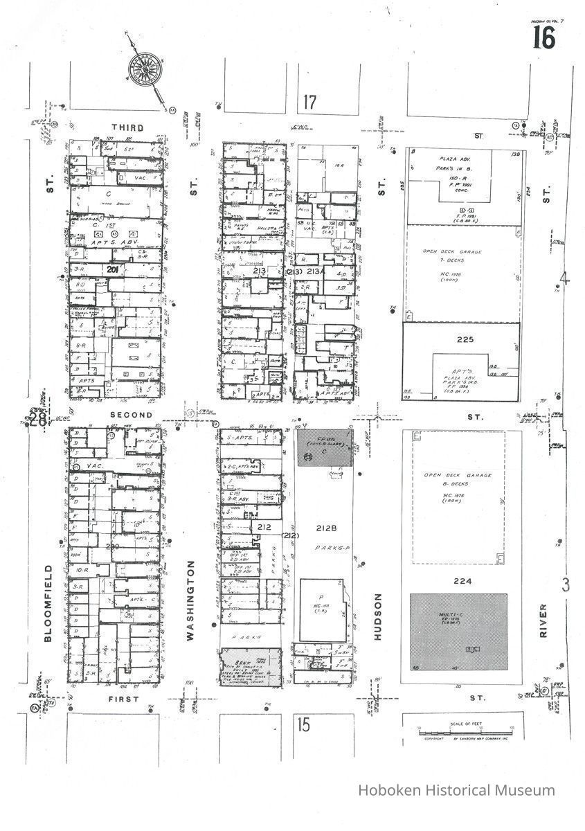
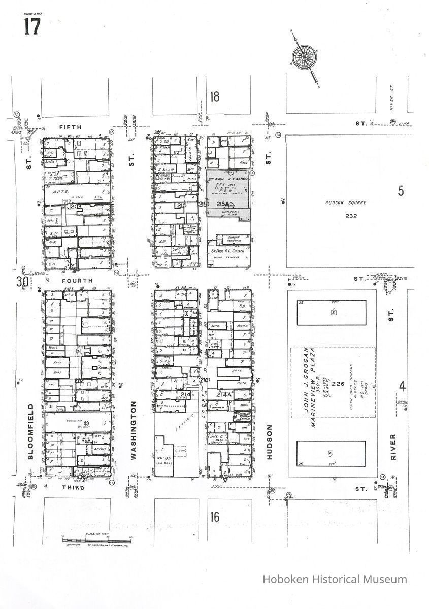
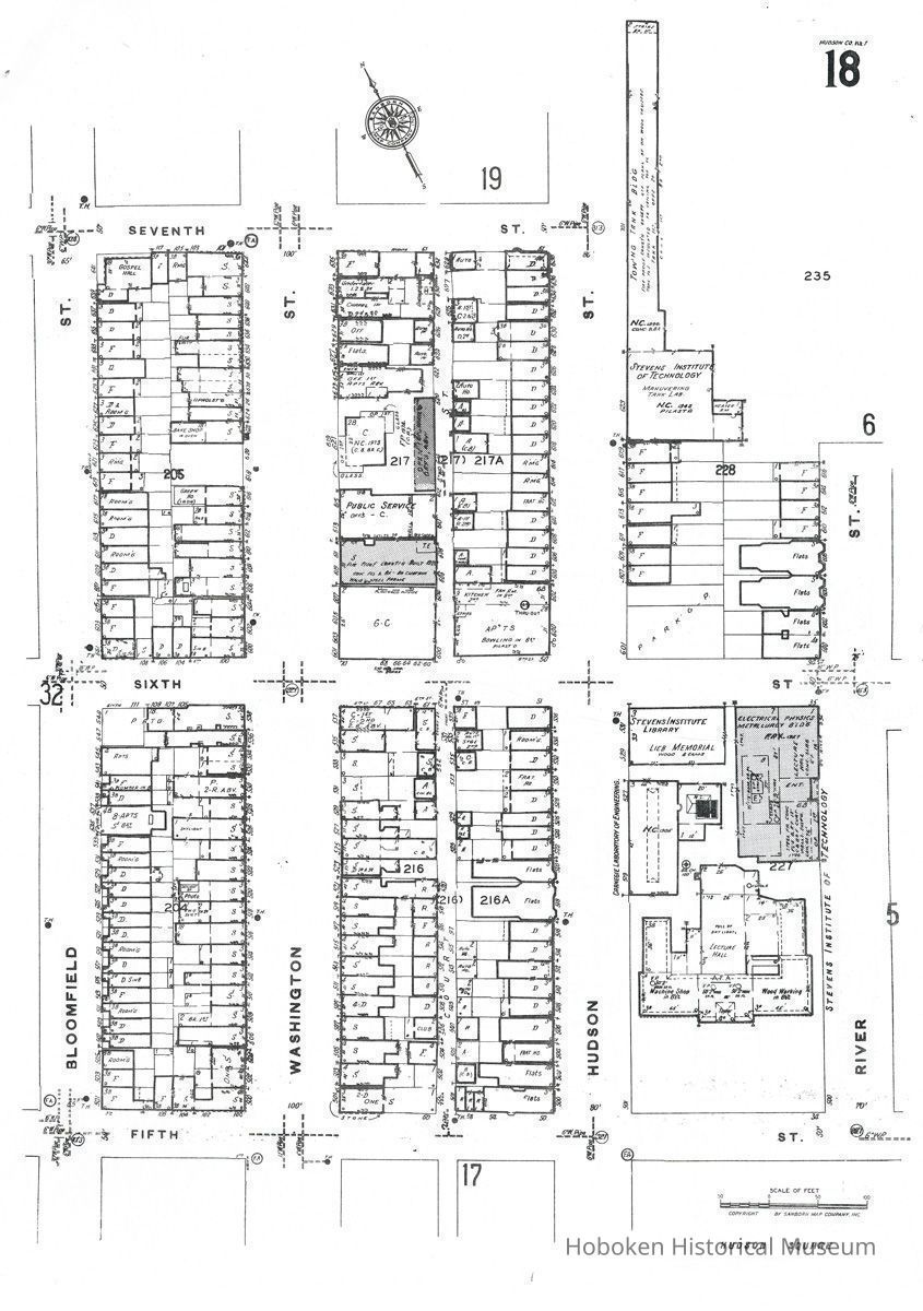
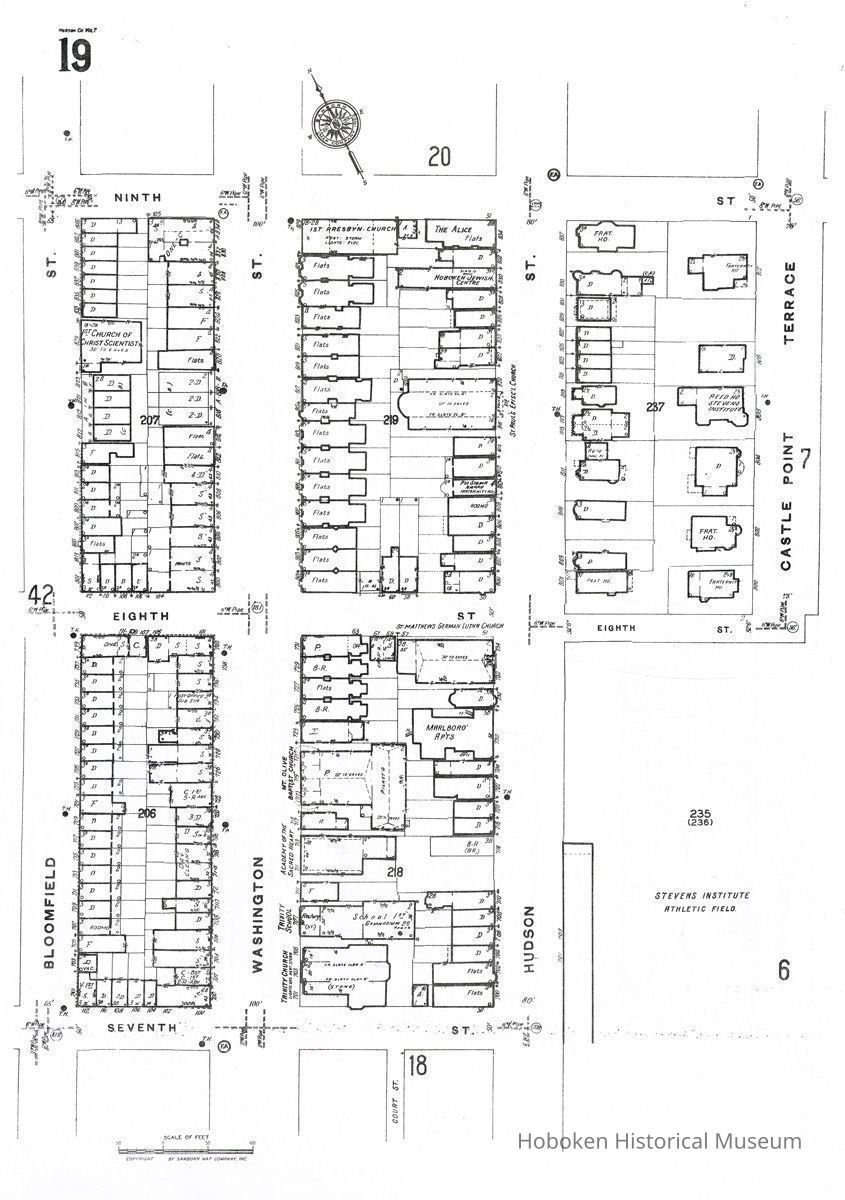
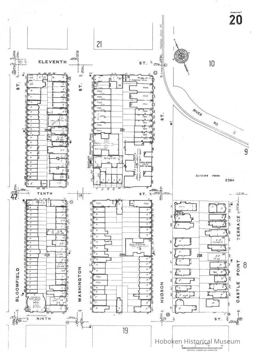
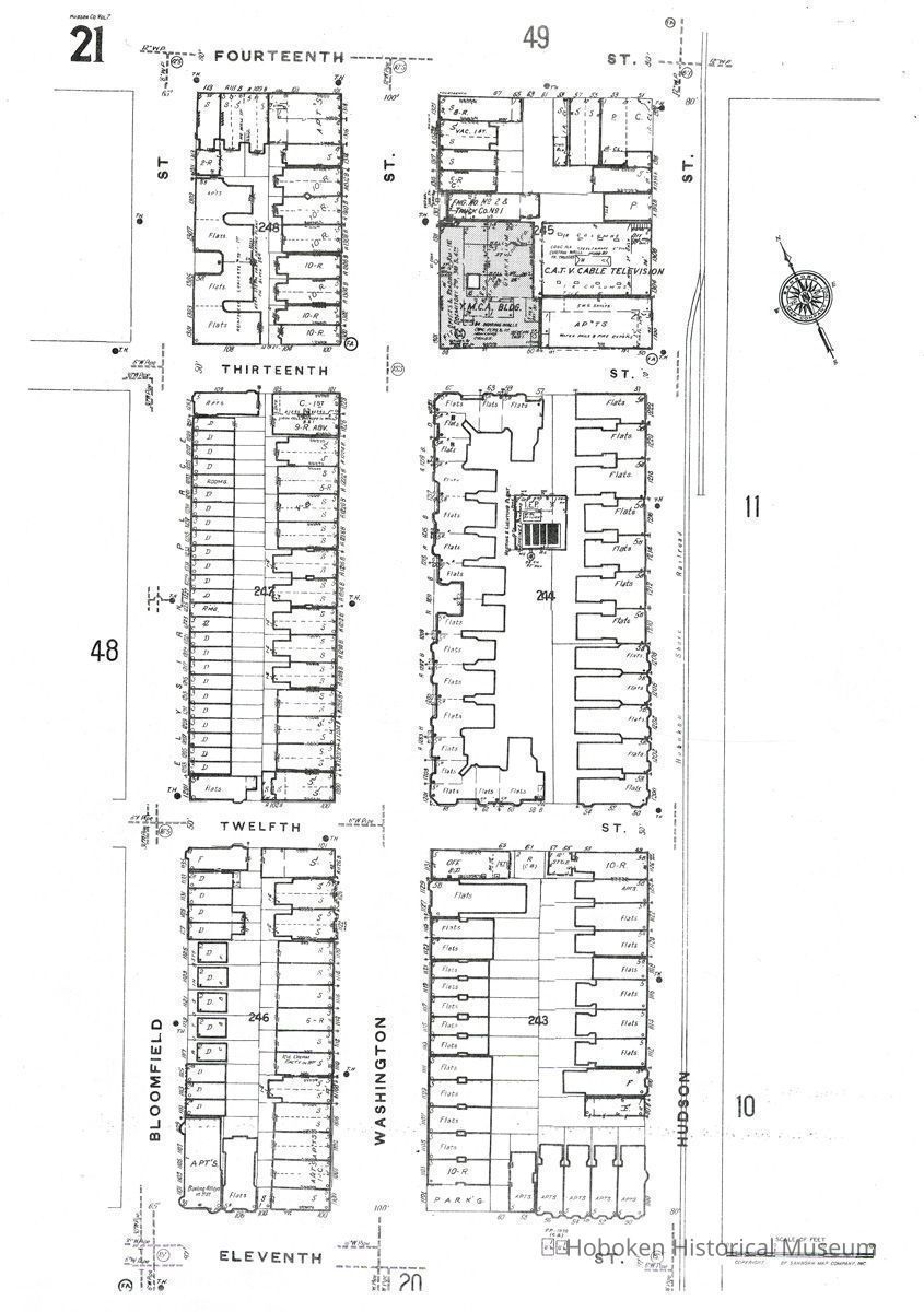
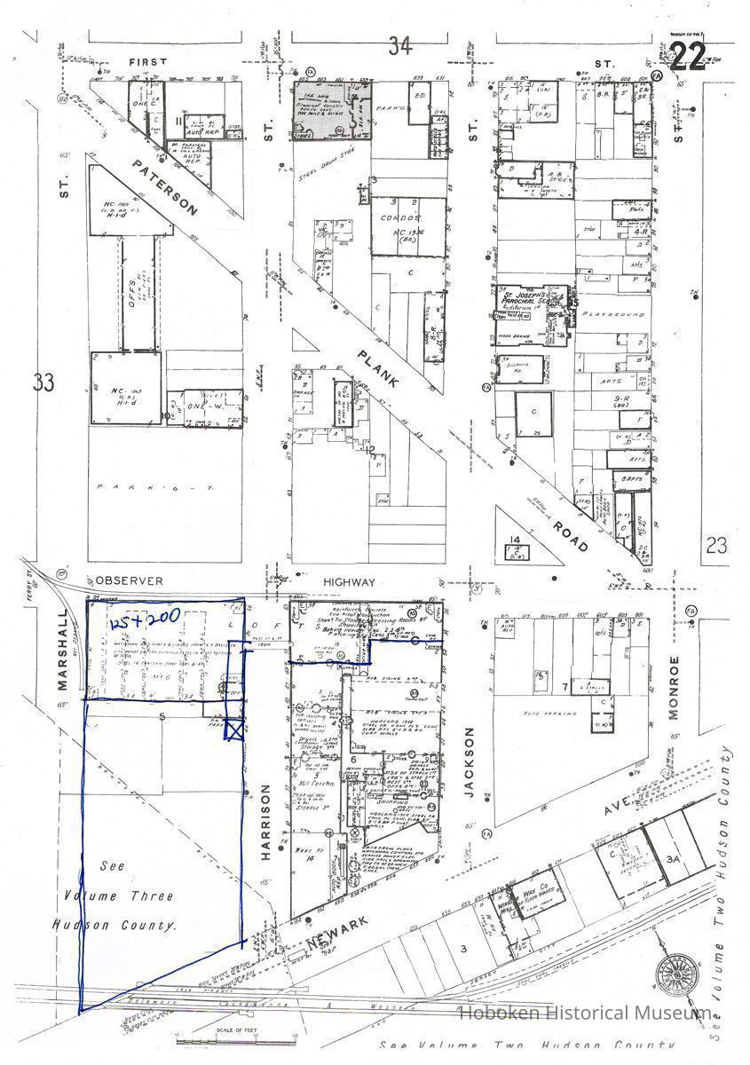
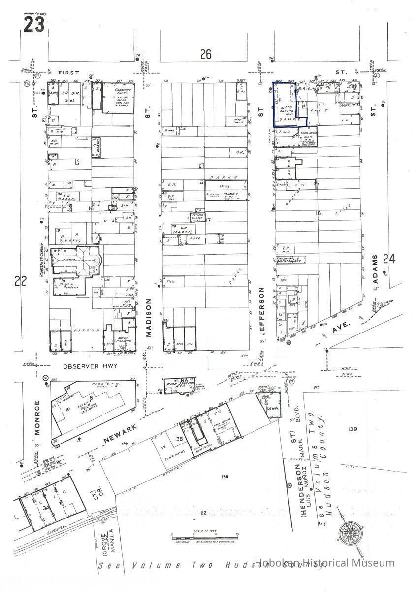
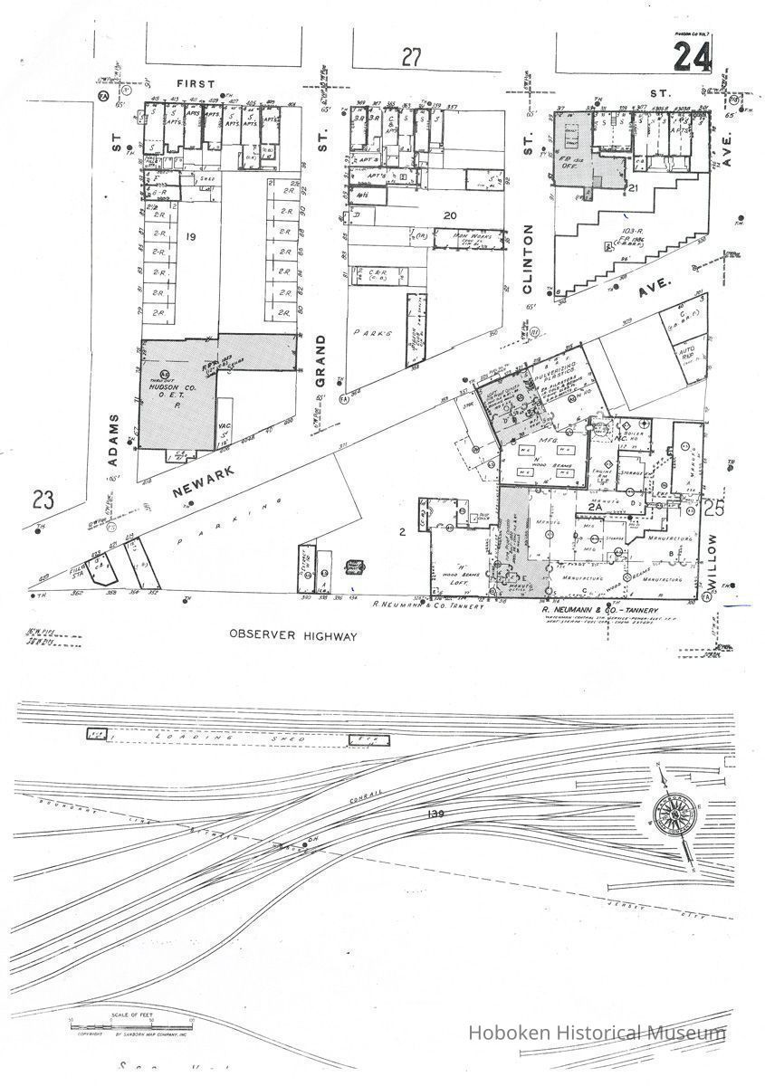
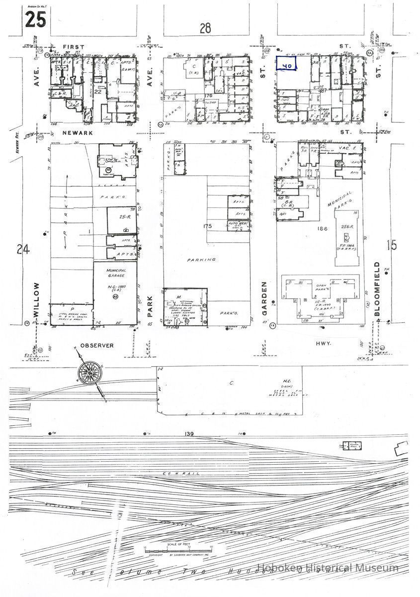
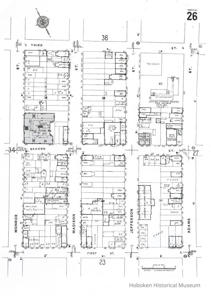
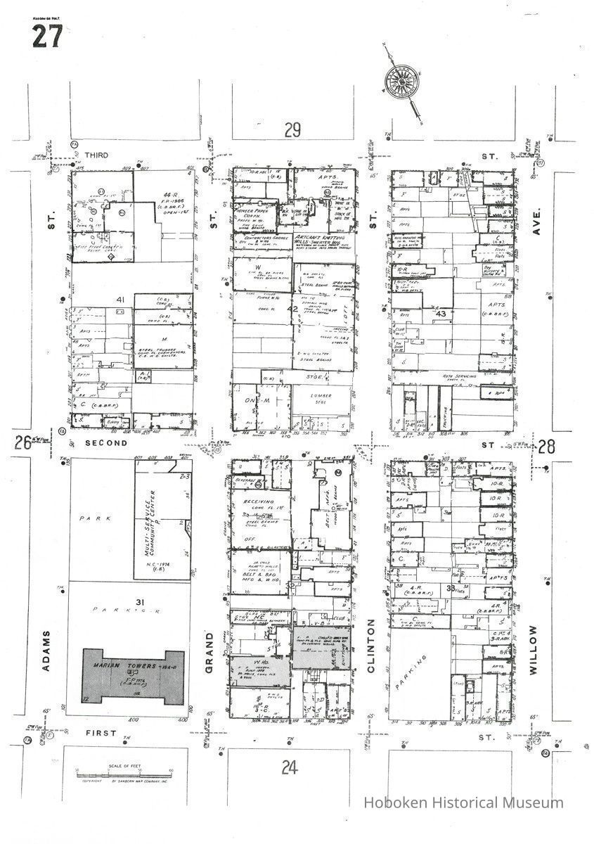
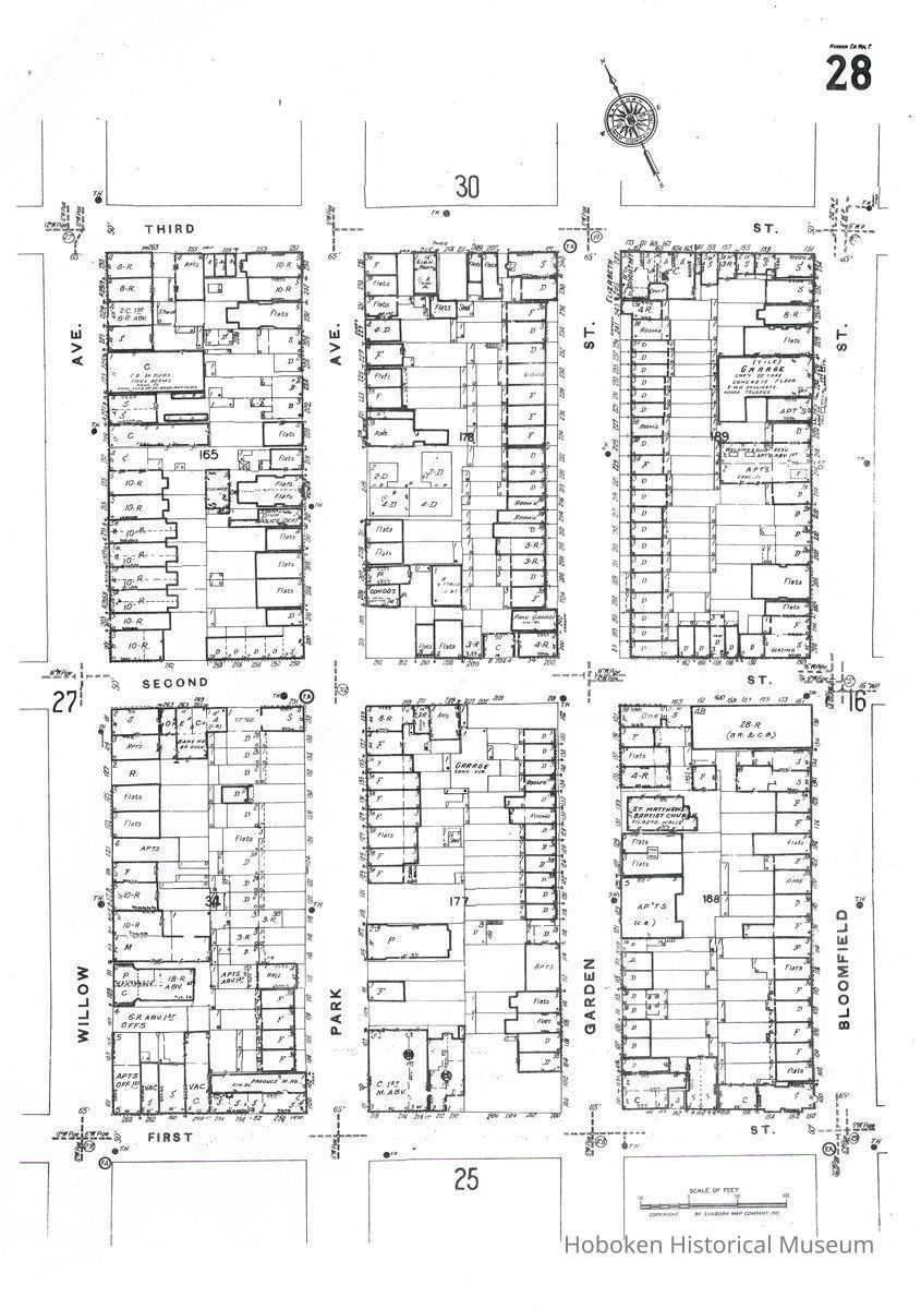
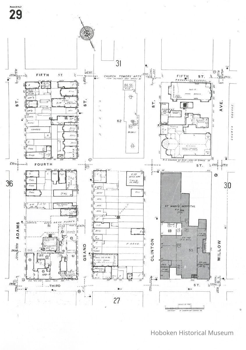
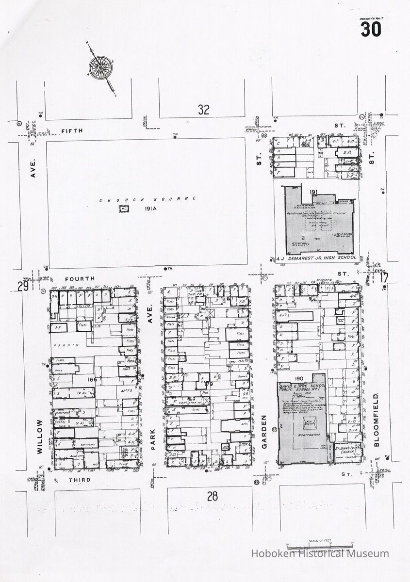
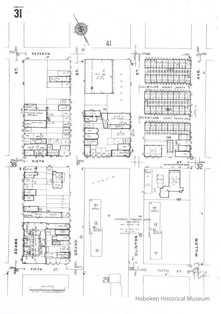
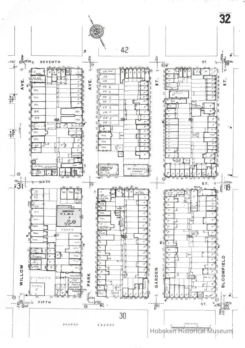
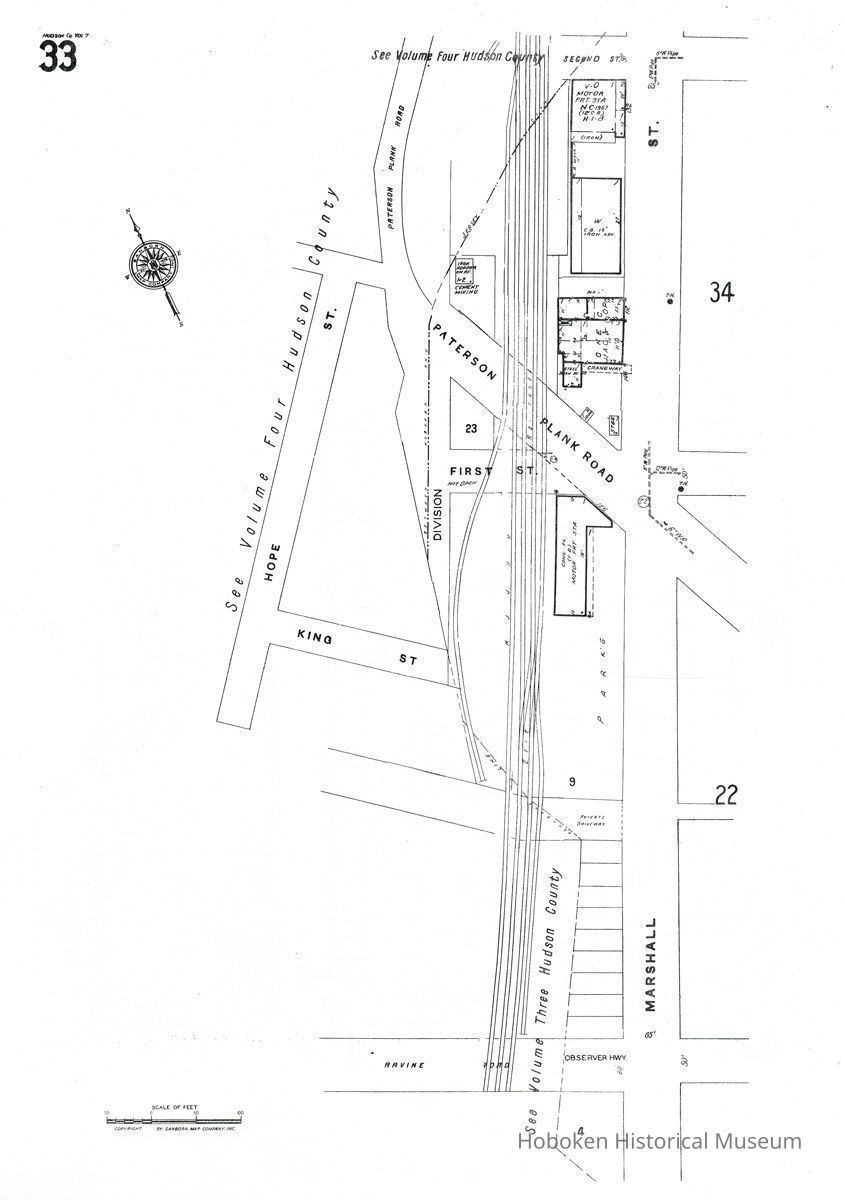
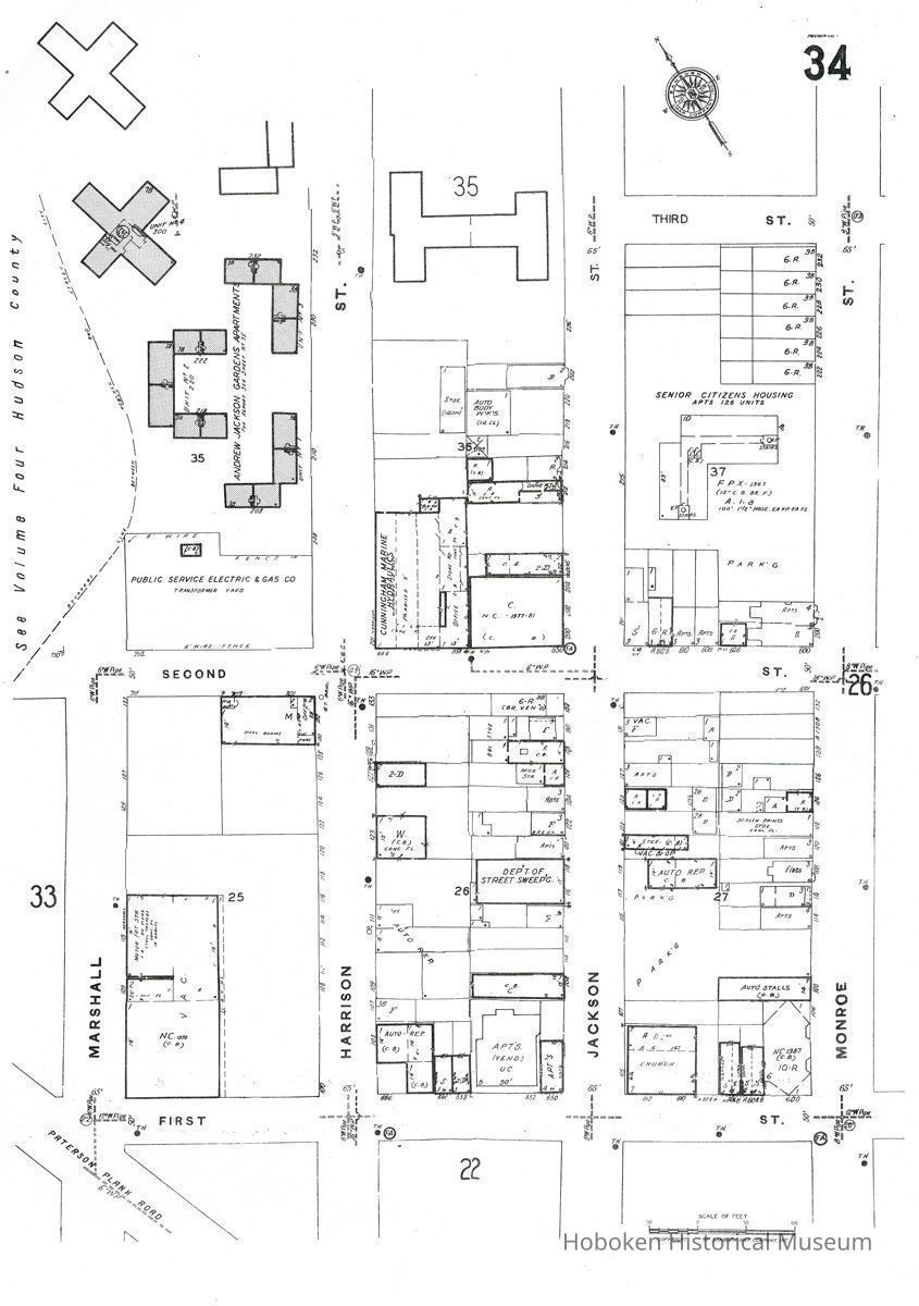
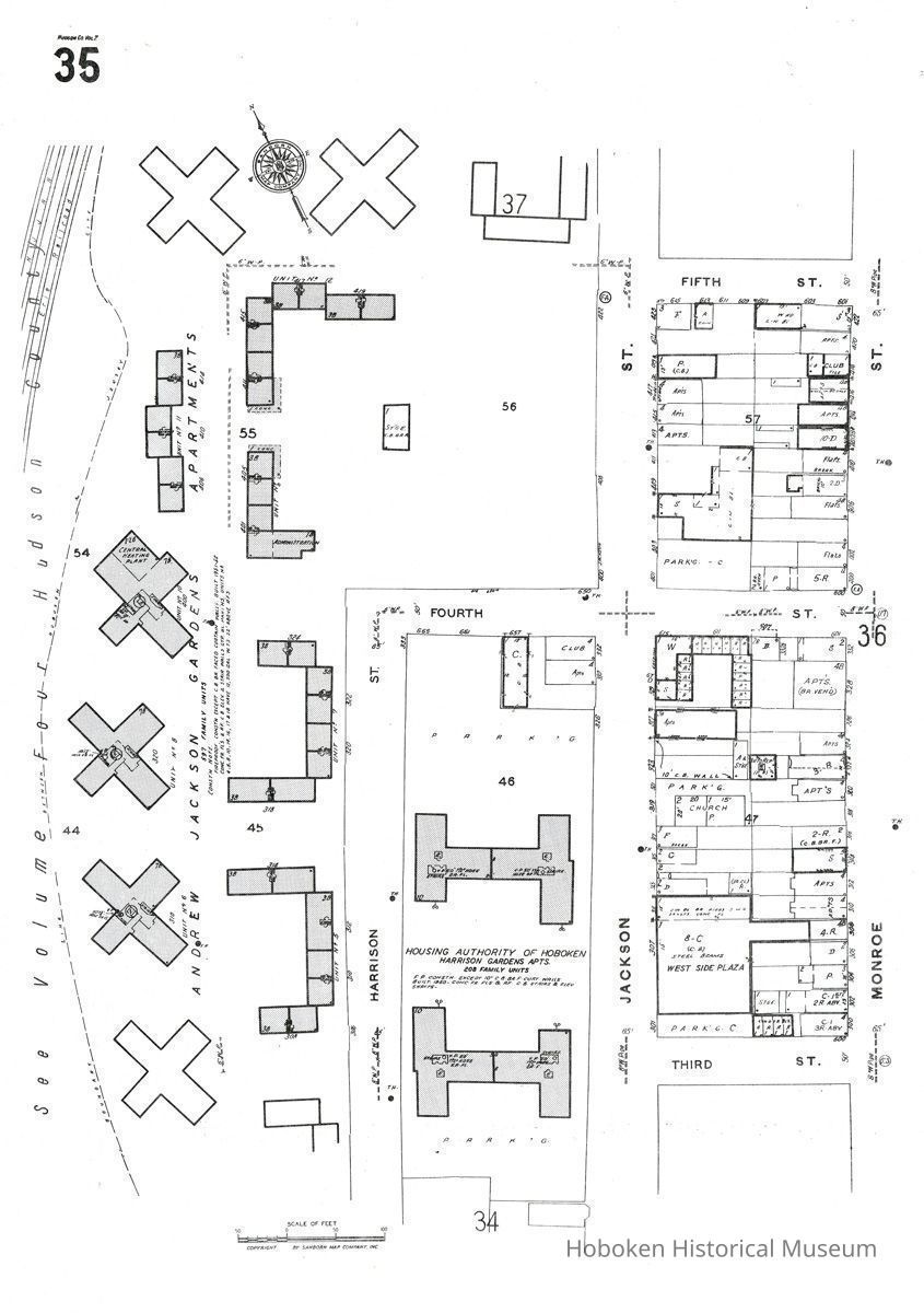
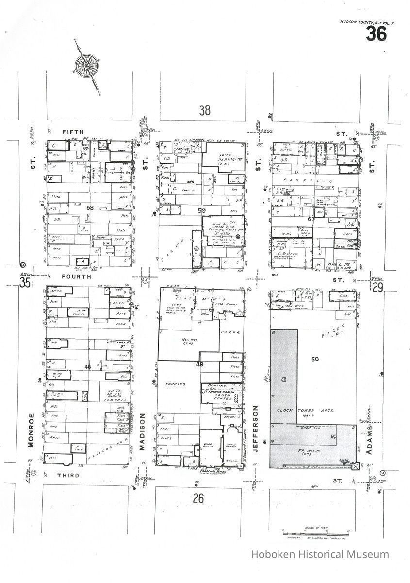
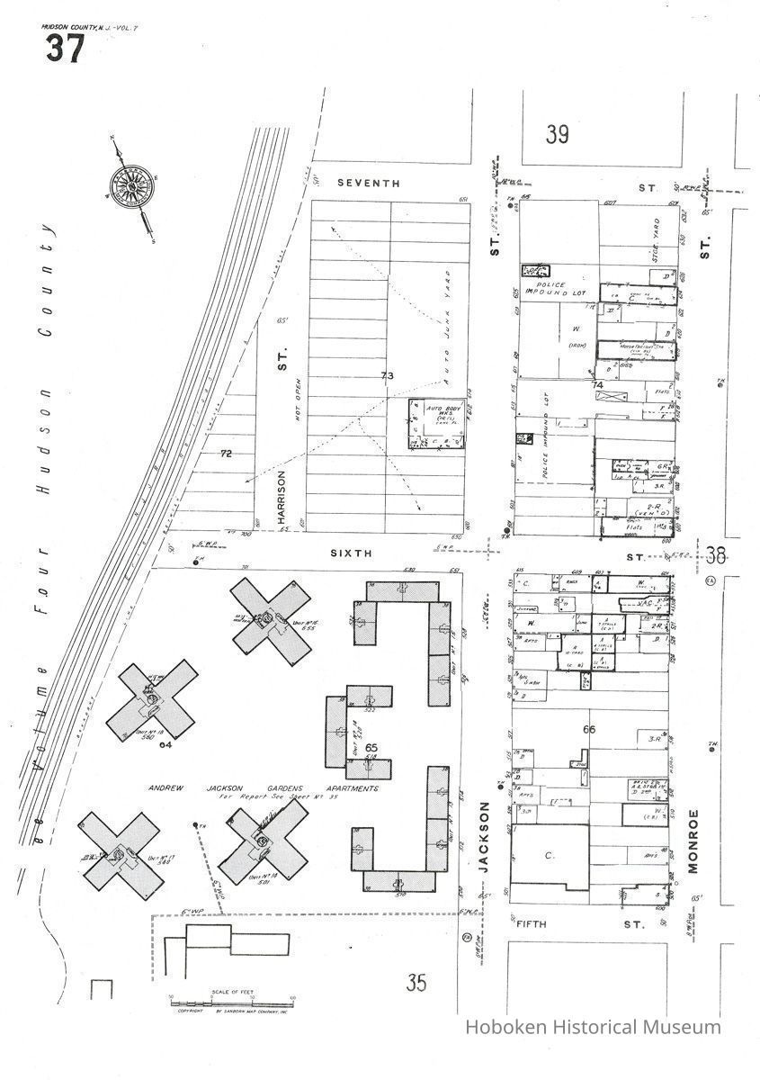
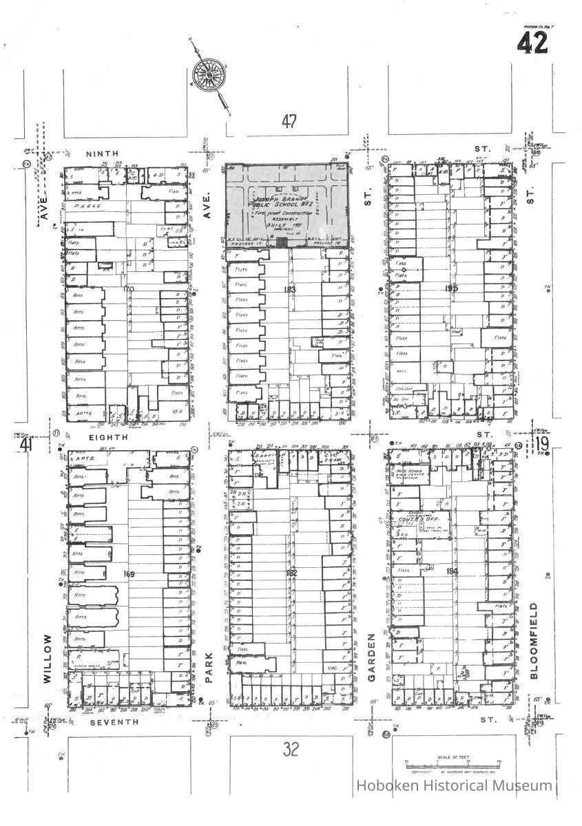
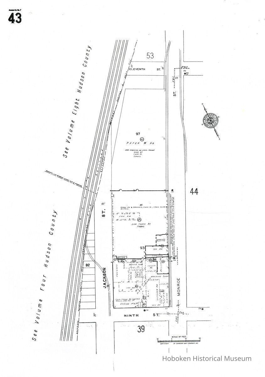
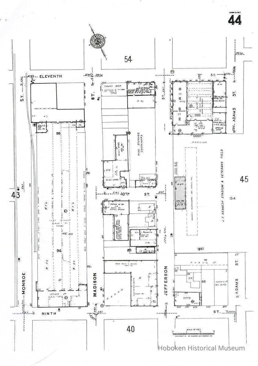
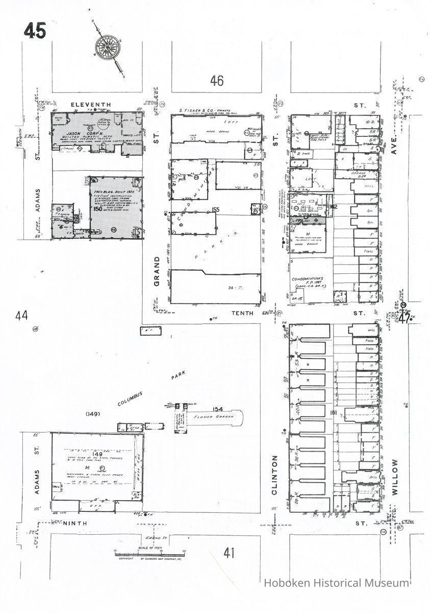
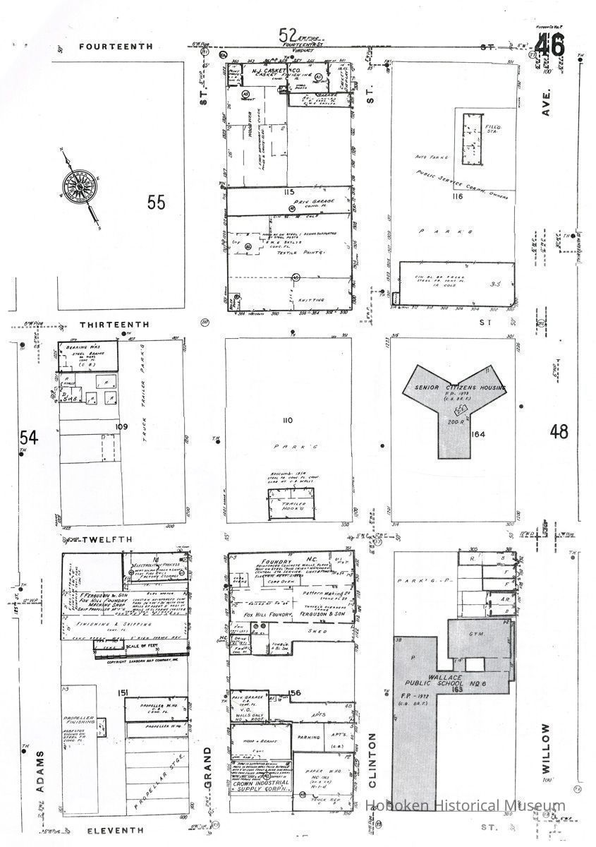
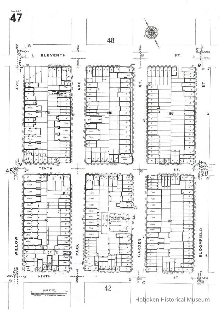
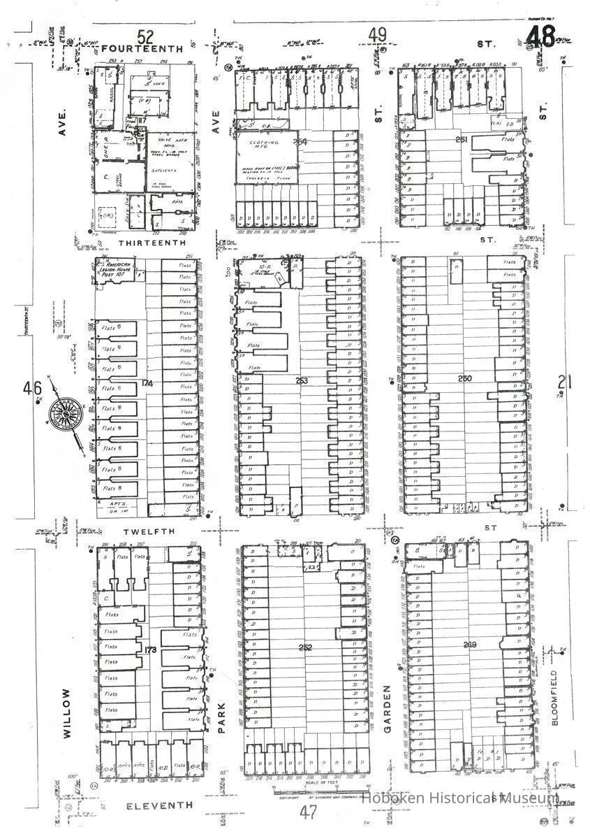
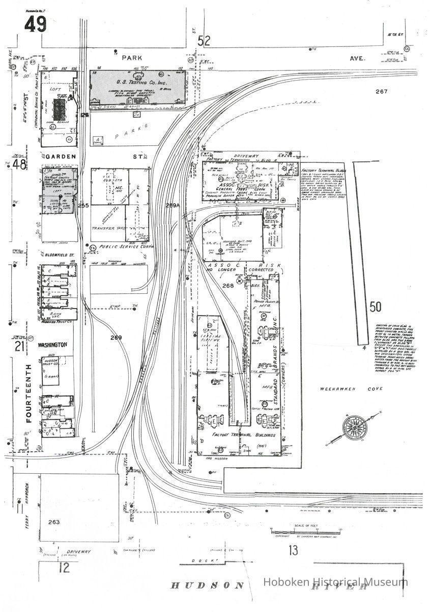
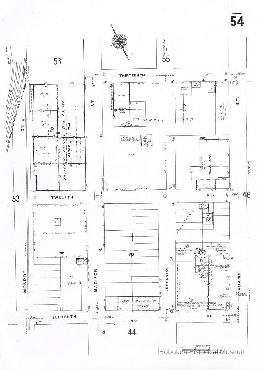
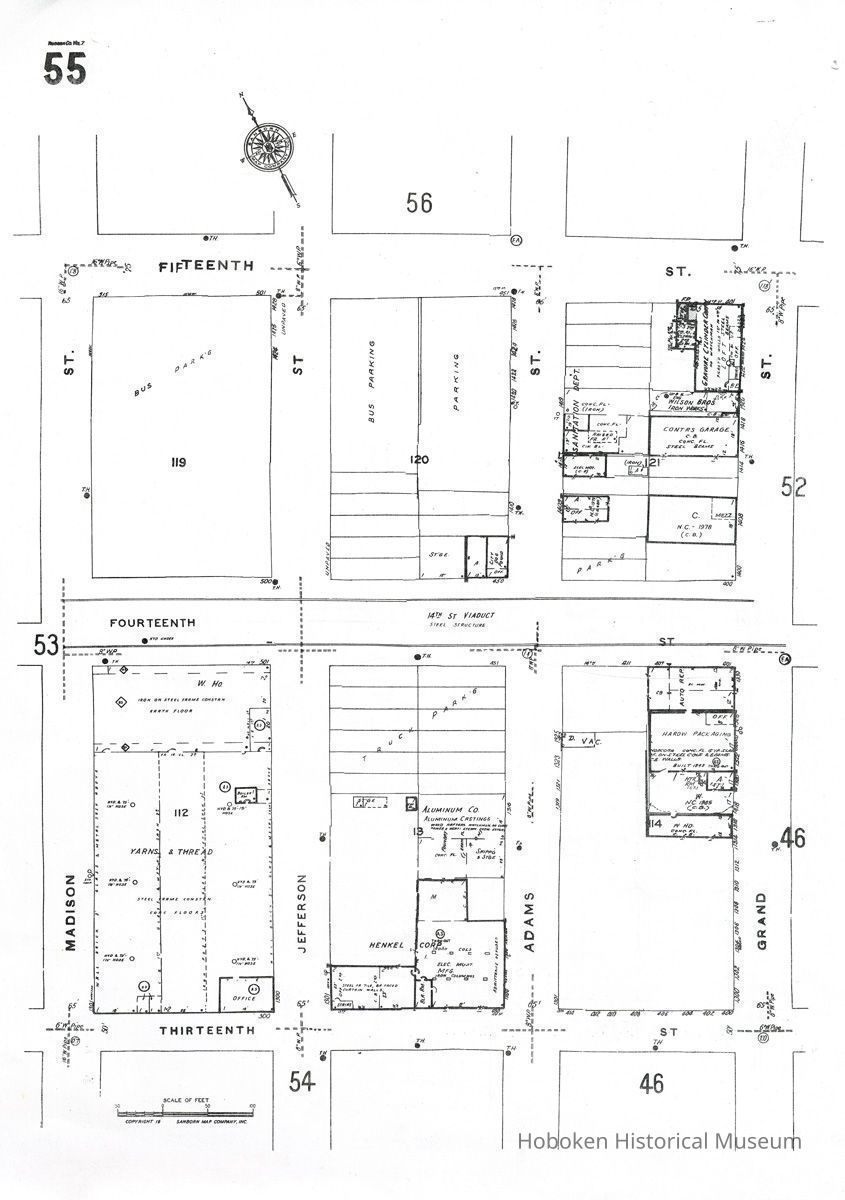
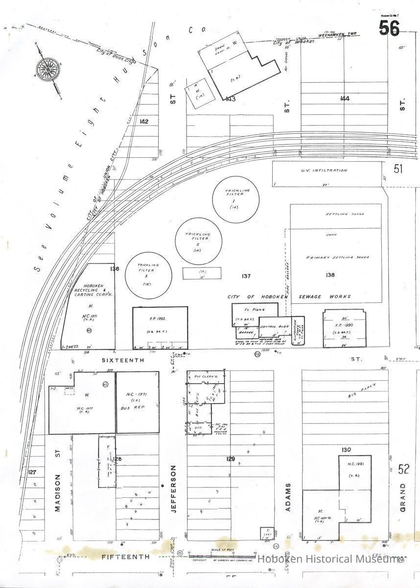
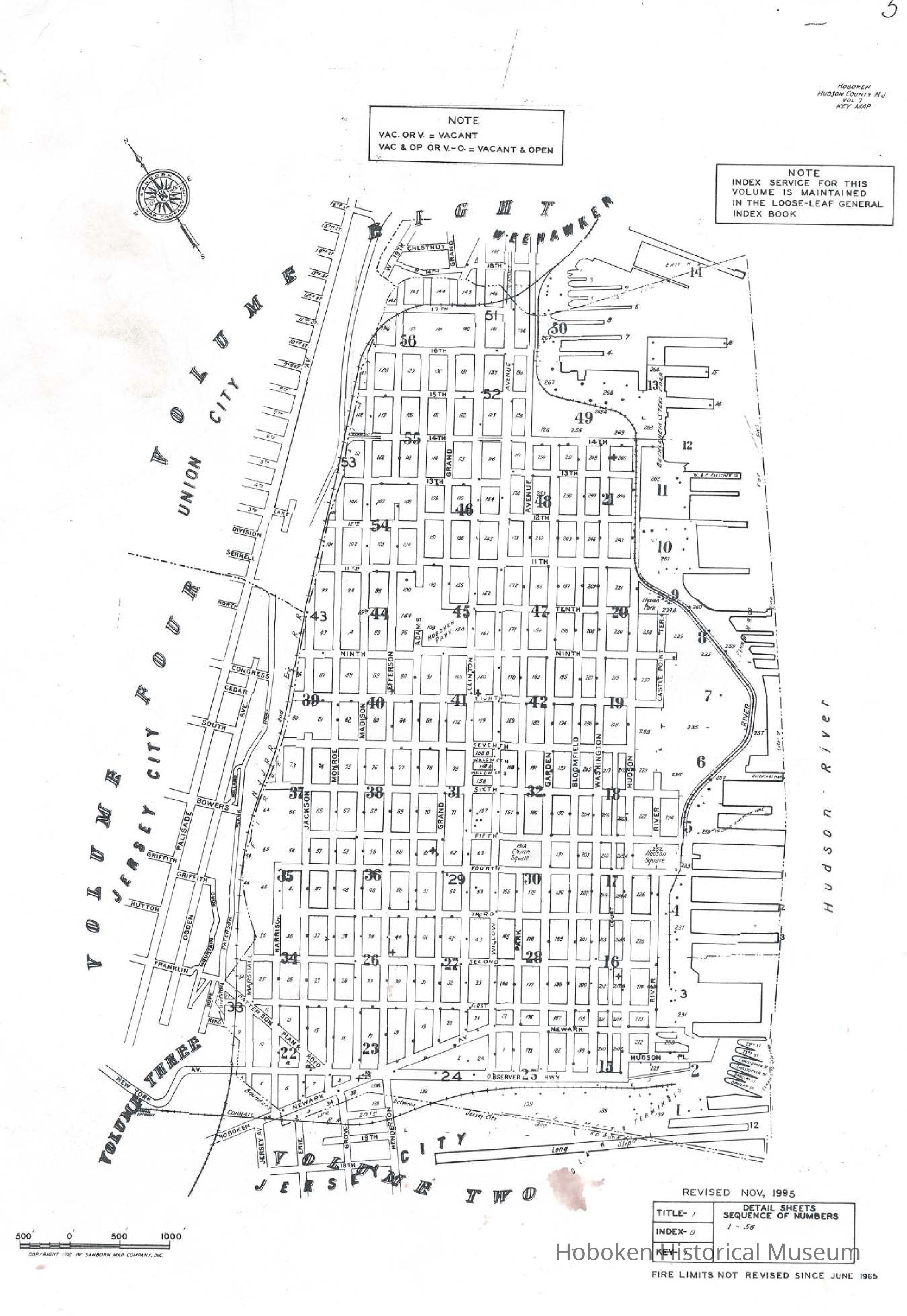
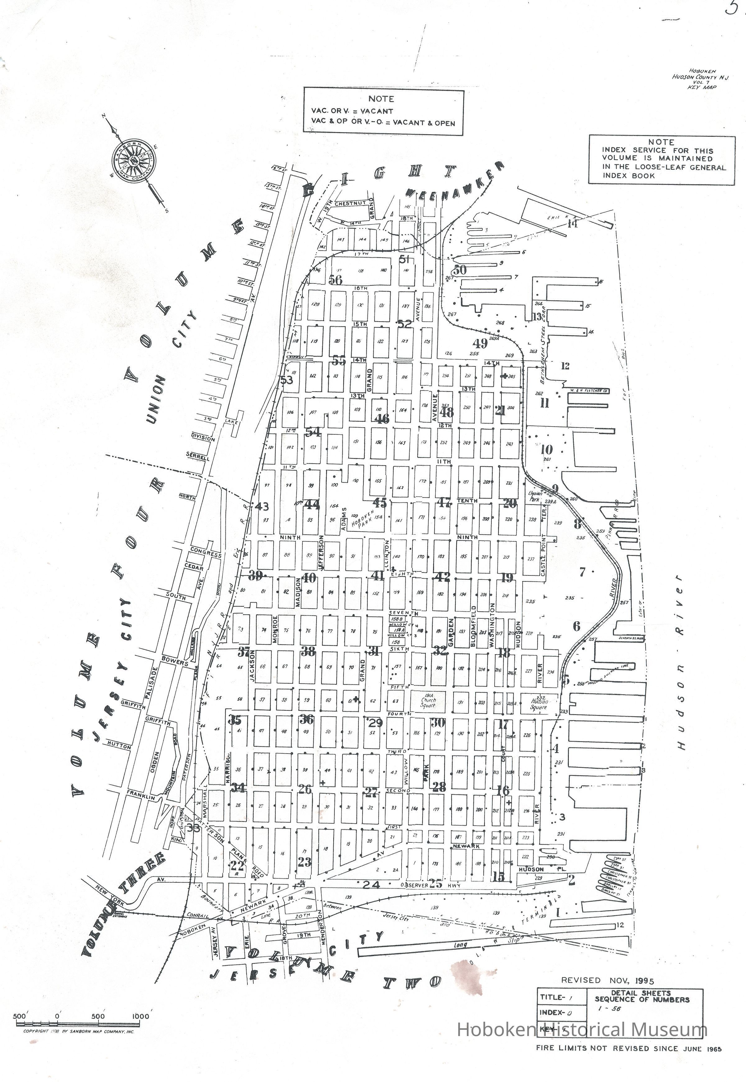
Sanborn Map, Hoboken, Hudson County, N.J., Volume 7. Key map plus detail sheets numbers 1-56. Revised November, 1995.
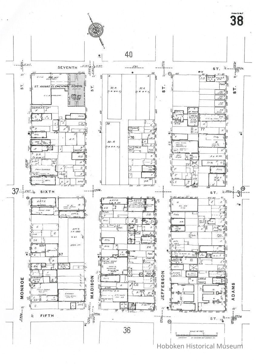
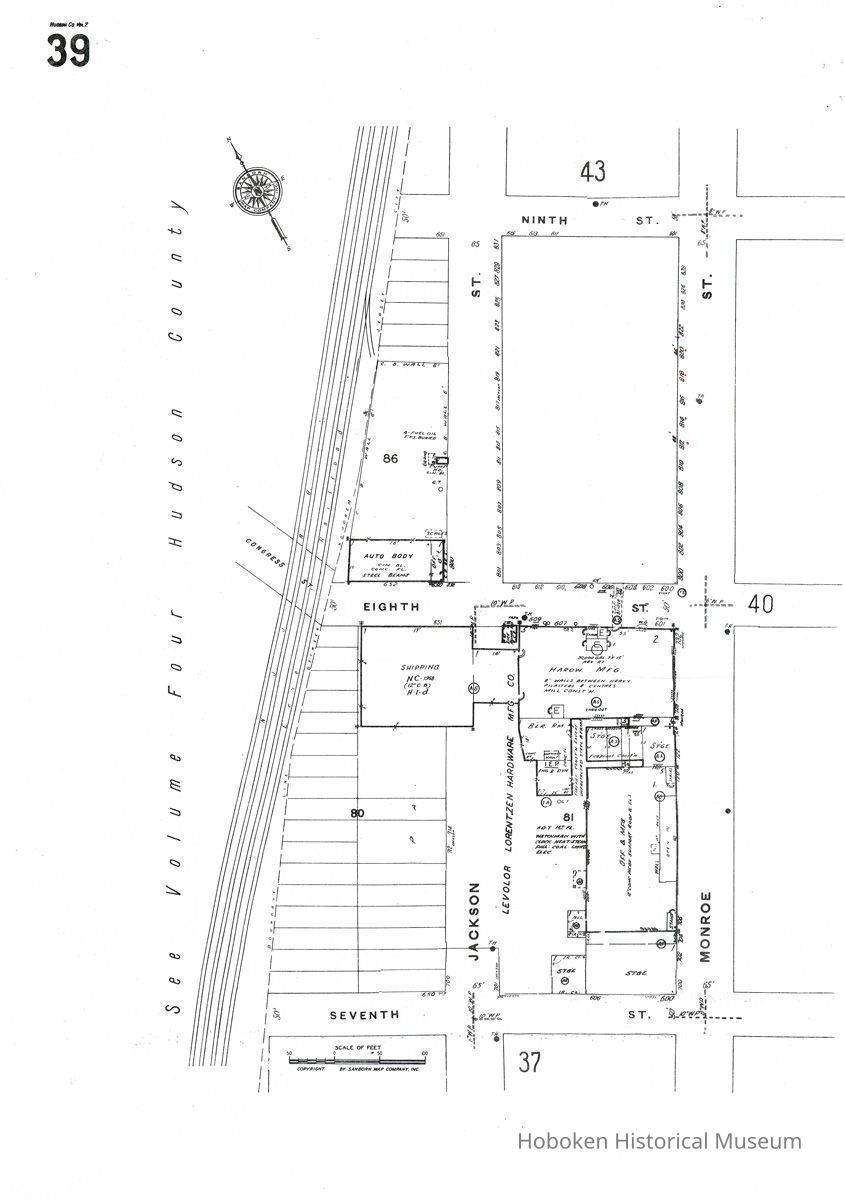
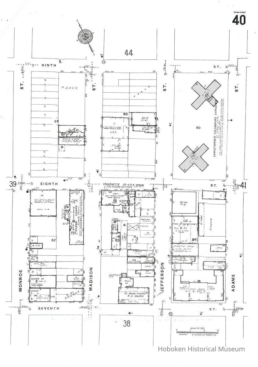
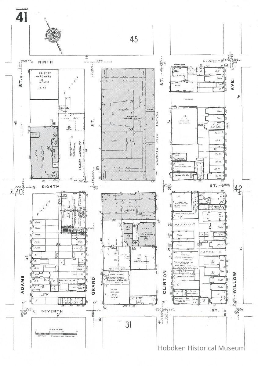
Map
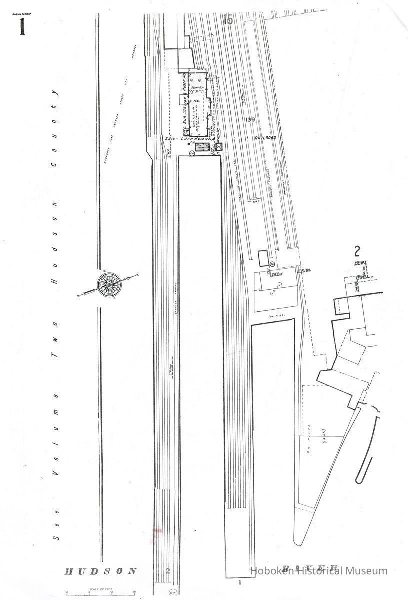
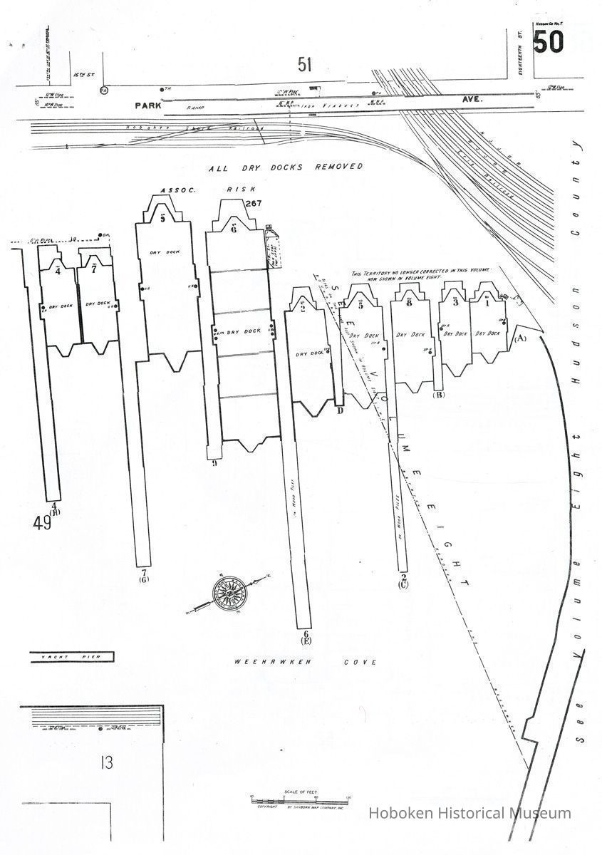
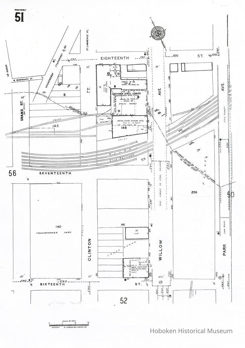
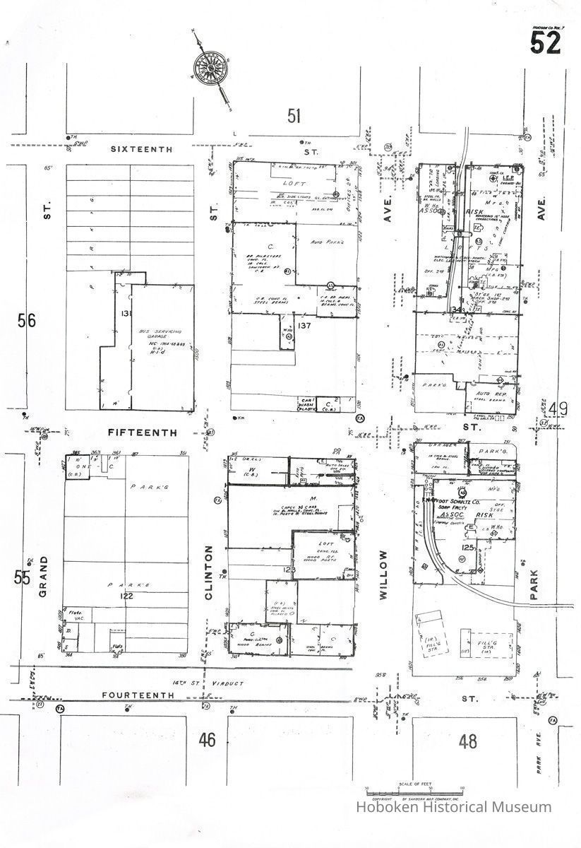
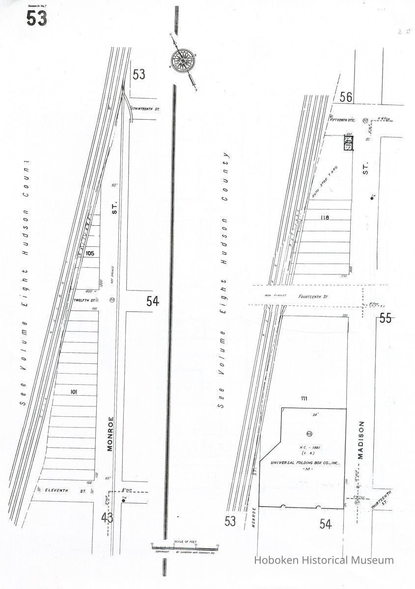
Sanborn Map, Hoboken, Hudson County, N.J., Volume 7. Key map plus detail sheets numbers 1-56. Revised November, 1995. Fire limits not revised since June 1965.
Printed in black on 29 leaves, 11" wide x 13-1/2" high; punched edge for plastic comb binding, binding not present. PDF on file.
Scale: 1 inch = 100 feet (except key map: 1 inch = 1000 feet.)
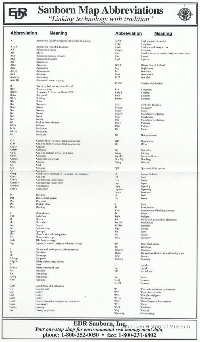
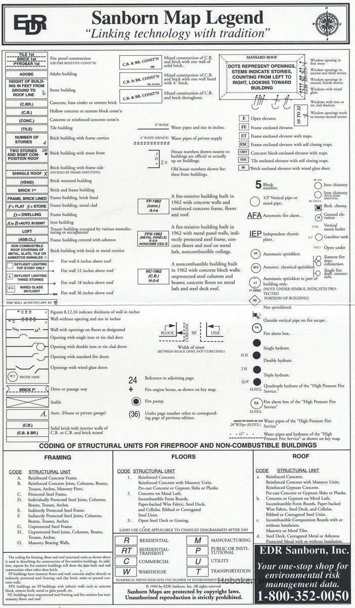
Map and related materials are copyright by Sanborn Map Company, Inc. and may not be reproduced without permission. It is offered here for reference purposes only. It is commonly known as a "Sanborn Fire Map" as it is routinely used for fire risk assessment. Key map is followed by a separate map abbreviation and map legend sheet.
2004.003.0023
2004.003
Found in collection
Found in Collection
Museum Collection.
1965 - 1995
Date(s) Created: 1965 - 1995 Date(s): 1965 -1995 Level of Description: Item
Display Value: Fair Notes: Find company online that currently publishes Sanborn Maps to purchase. Status: OK Status By: dw Status Date: 2004-10-27