Collections Item Detail
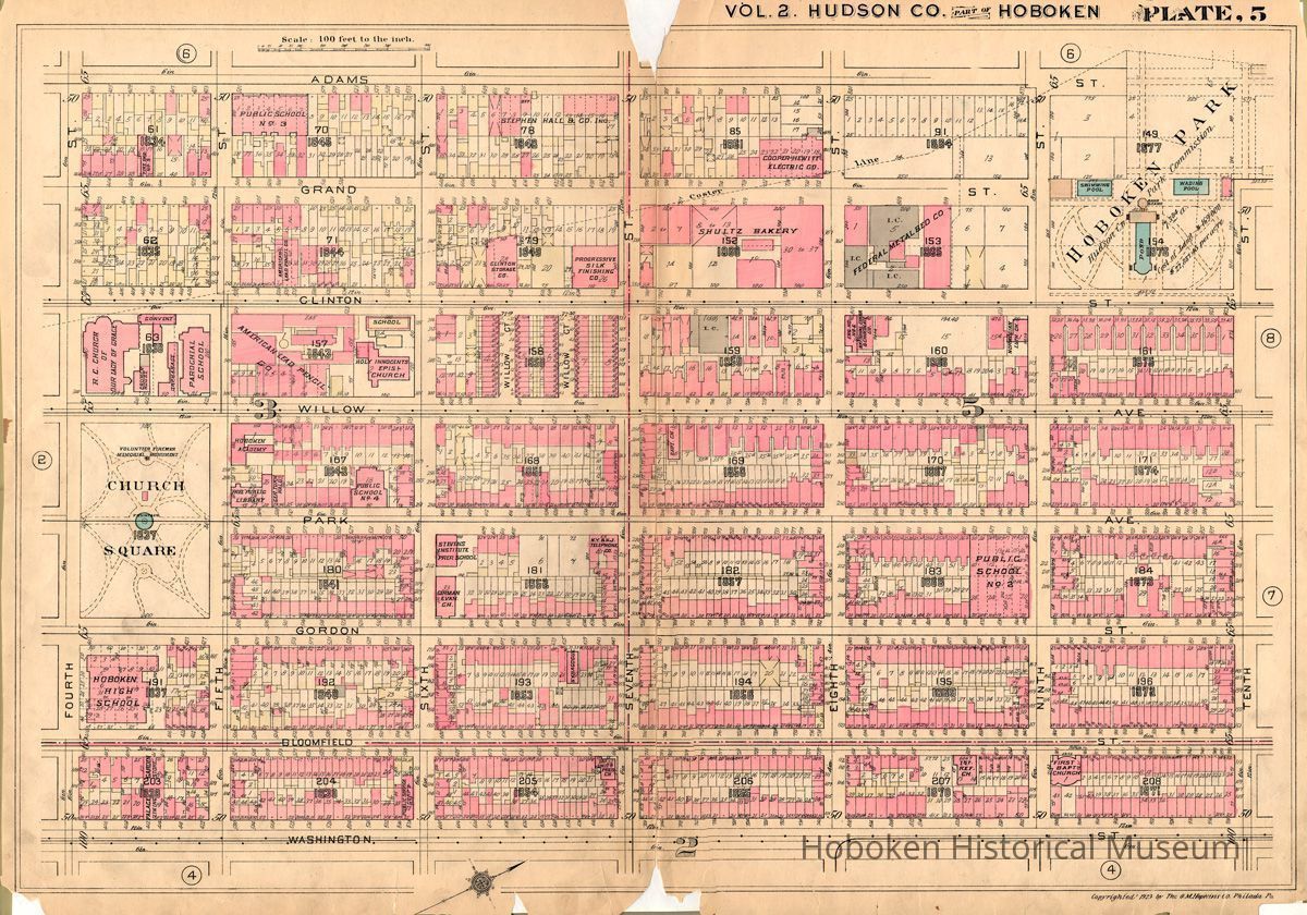
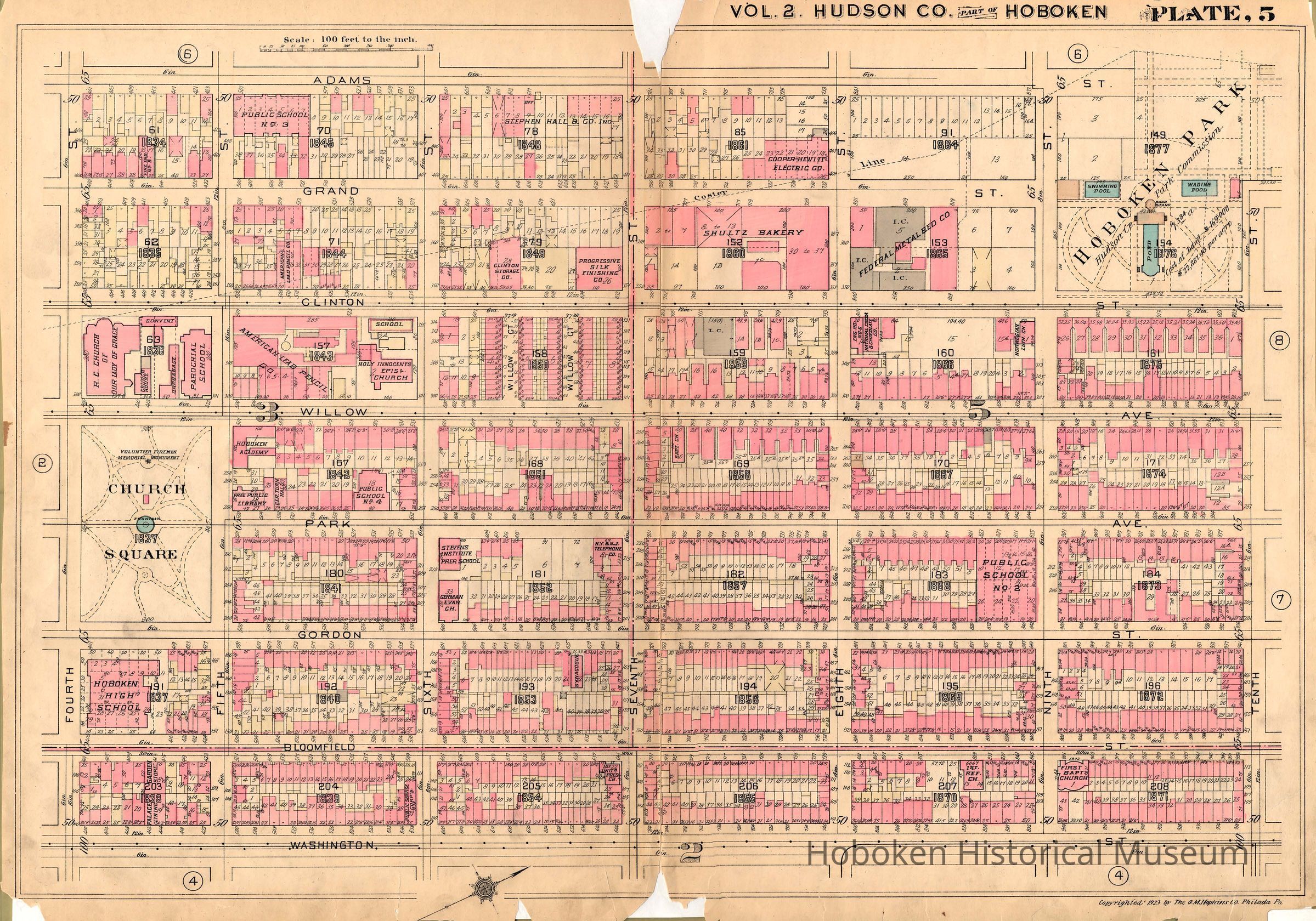
Plate 5 from Plat Book of Hudson County, Volume II. Philadelphia: G.M. Hopkins Co. (1923).
Map
Plate 5 from Plat Book of Hudson County. Vol. 2. Philadelphia: G.M. Hopkins Co. (1923). Original plate is ca. 23" high x 32" wide. Digital copy only; scan from original belonging to Hoboken Public Library. PDF on file. Tiff media archives.
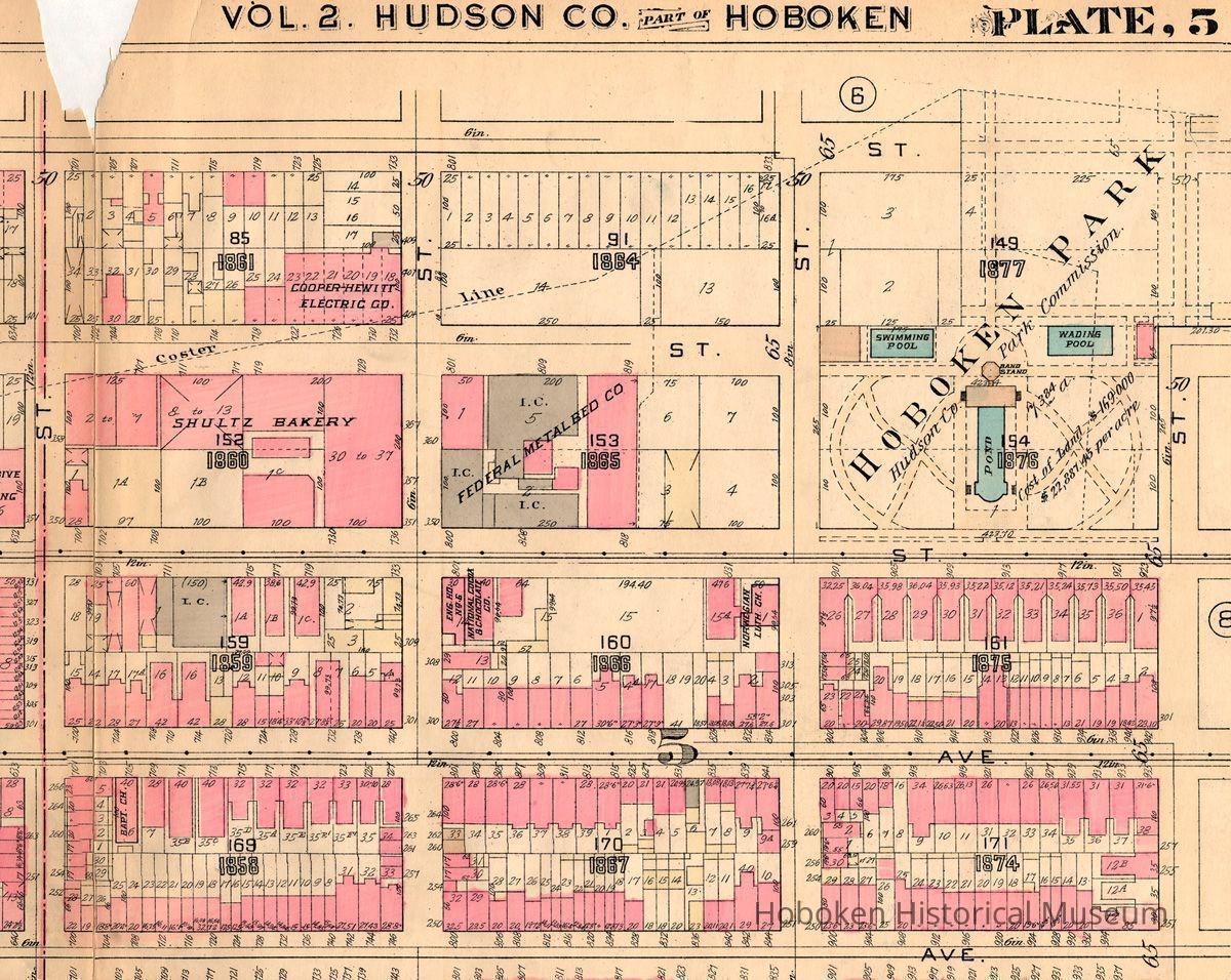
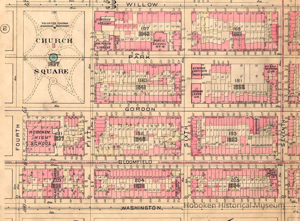
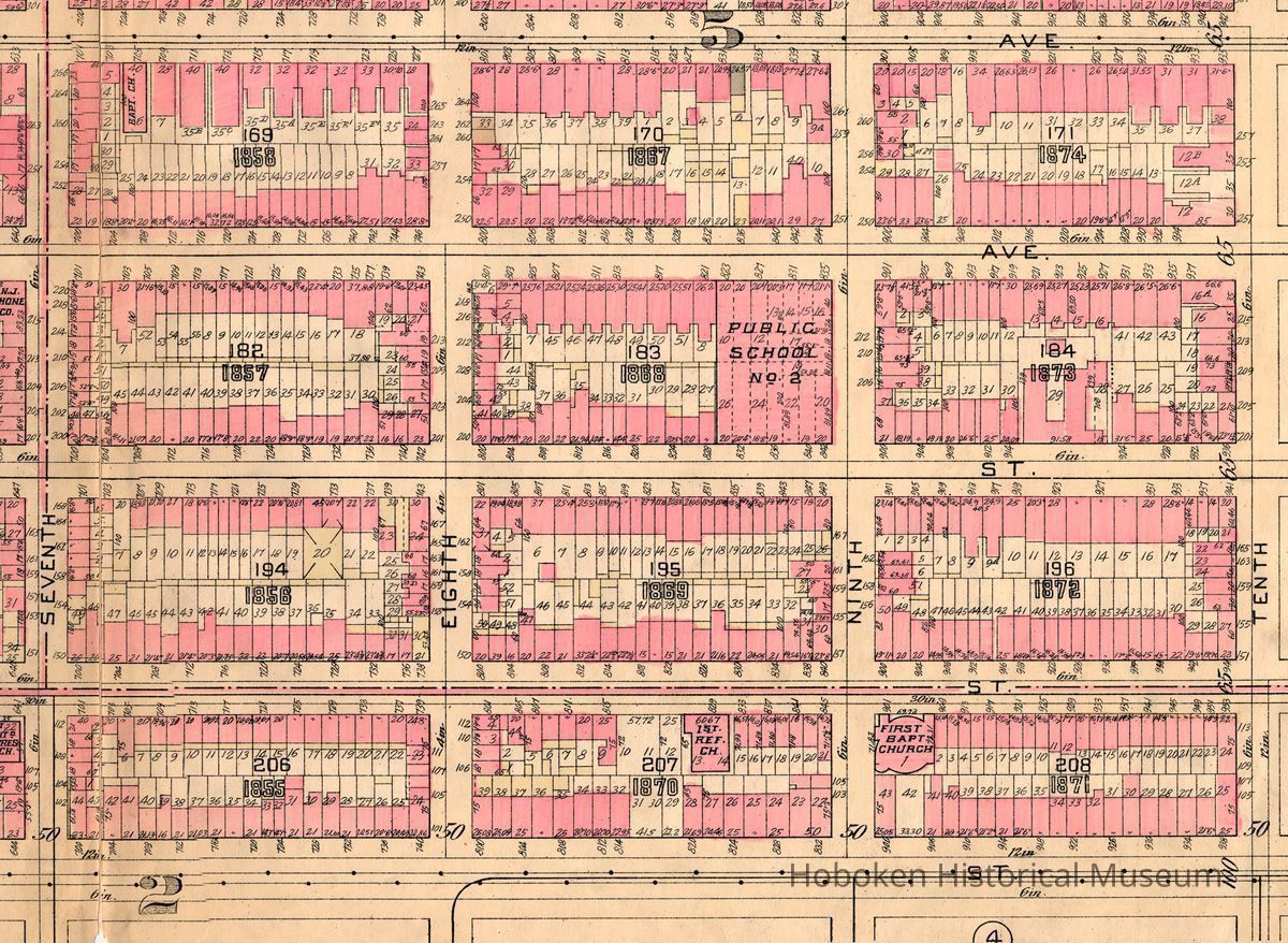
Shows area from the west side of Washington Street west to Adams Street and north from Fourth Street to Tenth Street. Full map and four overlapping detail images by quarters are seen. (Note: Garden Street is mispelled as "Gordon.")
Index map plate and Hoboken plates 1 to 8 and 12 are catalogued as archives 2004.004.0200 to .0209.
2004.004.0205
2004.004
Staff
Collected by Staff
Museum collection.
1923 - 1923
Date(s) Created: 1923 Date(s): 1923-1923 Level of Description: Item
Not Rated
Display Value: Good Notes: Original in the Hoboken Public Library is mylar encapsulated with some backing sheets which show at the chipped edges or folds. Items were not removed from the mylar sleeves when scanned. While scanned at same size, the images on files may not be original thus scales indicated on the map may not be true. Status: OK Status By: dw Status Date: 2008-11-20