Collections Item Detail
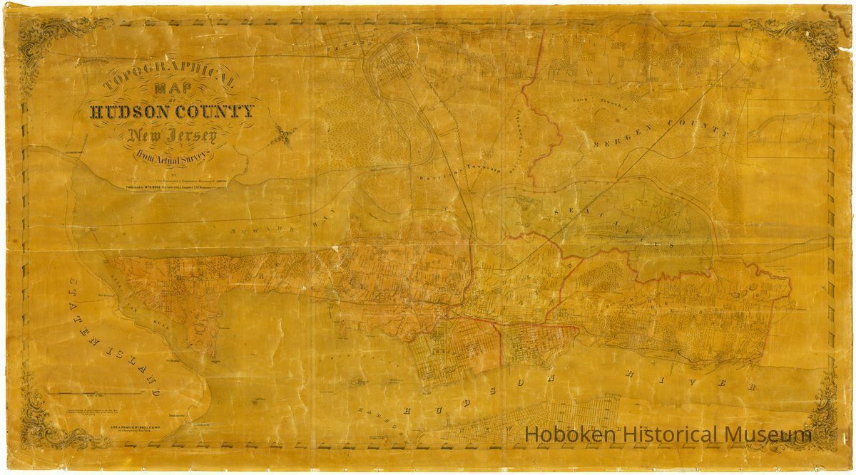
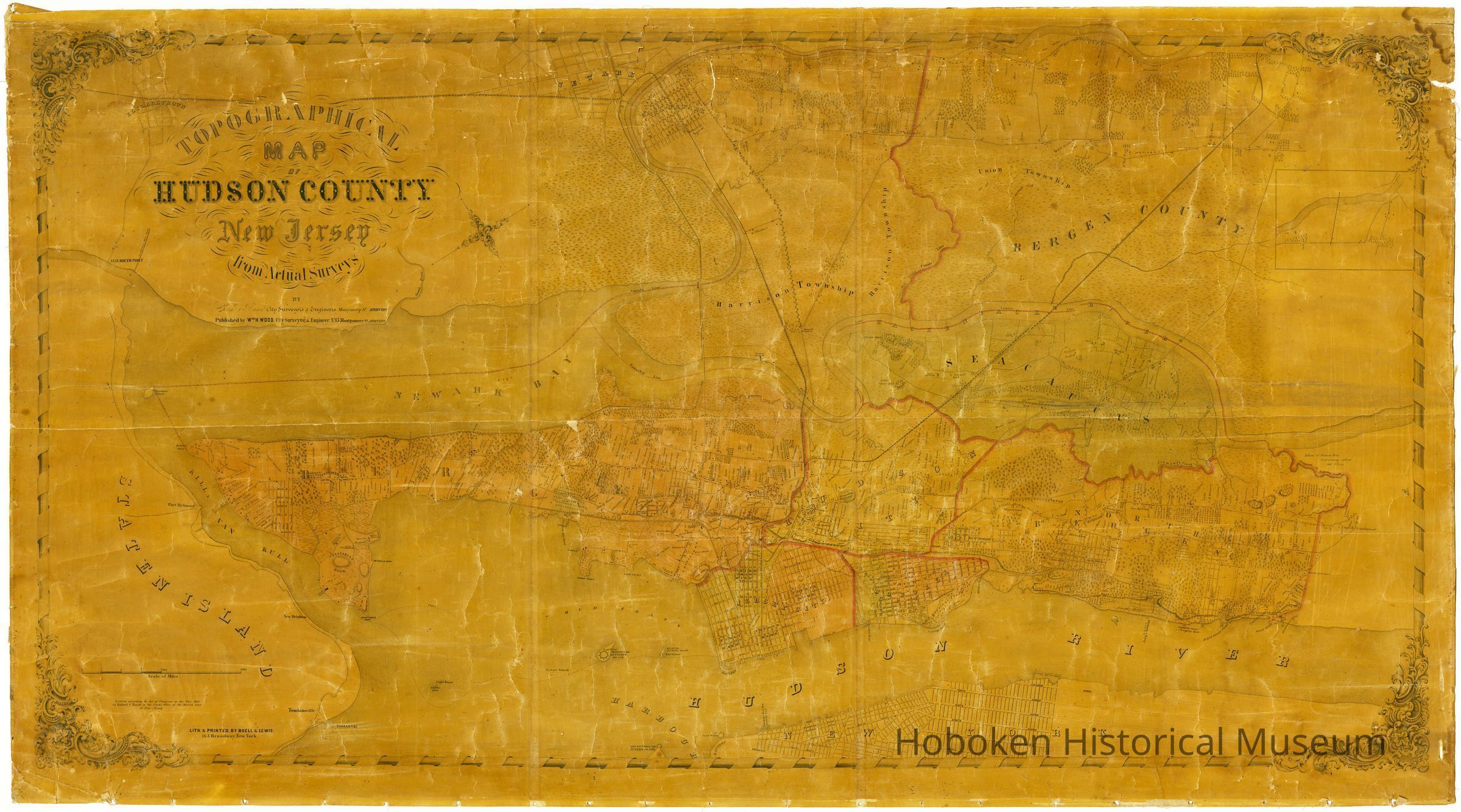
Topographical Map of Hudson County, New Jersey from Actual Surveys. Clerk & Bacot, City Surveyors & Engineers, Jersey City, 1854.
Map
Topographical Map of Hudson County, New Jersey from Actual Surveys.
By Clerk & Bacot, City Surveyors & Engineers, Montgomery St., Jersey City.
Published by Wm. H. Wood, City Surveyor & Engineer, No. 15 Montgomery St., Jersey City.
Entered according to Act of Congress in the Year 1854 by Robert C. Bacot in the Clerk's Office of the District Court of New Jersey.
Lith. & Printed by Boell & Lewis, 163 Broadway, New York.
Printed paper mounted on linen.
This is an early map with the Hudson County name in its title. It reflects some common elements of an earlier map, the Douglass Map of 1841. It shows the full county, but many communities are not yet members of the county at this time although many of them appear on the map as developments.
This map was once a reference map used by the Township (now City) of Hoboken and is severely darkened by age making it difficult to read. It has been scanned and enhanced for usability.
PDF on file. All sectional scans and tiffs, media archive and on disk.
2002.014.0002
2002.014
Hoboken, City of; Haack, Roy, Director of Public Services
Donation
Gift of City of Hoboken; Department of Public Services
1854 - 1854
Date(s) Created: 1854 Date(s): 1854-1854
Poor
Notes: Scanned 2013; exhibited 2013: Mapping the Territory; Hoboken Historical Museum. Status: OK Status By: dw Status Date: 2009-10-31