Collections Item Detail
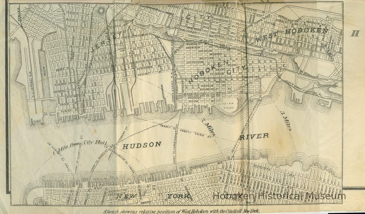
Digital image of map detail from Map of West Hoboken, N.J. (Assessor's Tax Roll). 1888.
Map
Digital image of map detail from Map of West Hoboken, N.J. (Assessor's Tax Roll). 1888. The original foldout map is ca. 36" high x 48" wide. This map shows the distance of West Hoboken, Hoboken and Jersey City from City Hall, New York was at the lower right corner and approx. 9" high x 14" wide. Ferries and railroads are indicated.
PDF on file of lower right portion of map.
2003.043.0001
2003.043
Union City Public Library Friends, Inc.
Donation
Courtesy of Union City Public Library Friends.
1888 - 1888
Date(s) Created: 1888 Date(s): 1888 Level of Description: Item
Status: OK Status By: dw Status Date: 2013-06-16


