Collections Item Detail
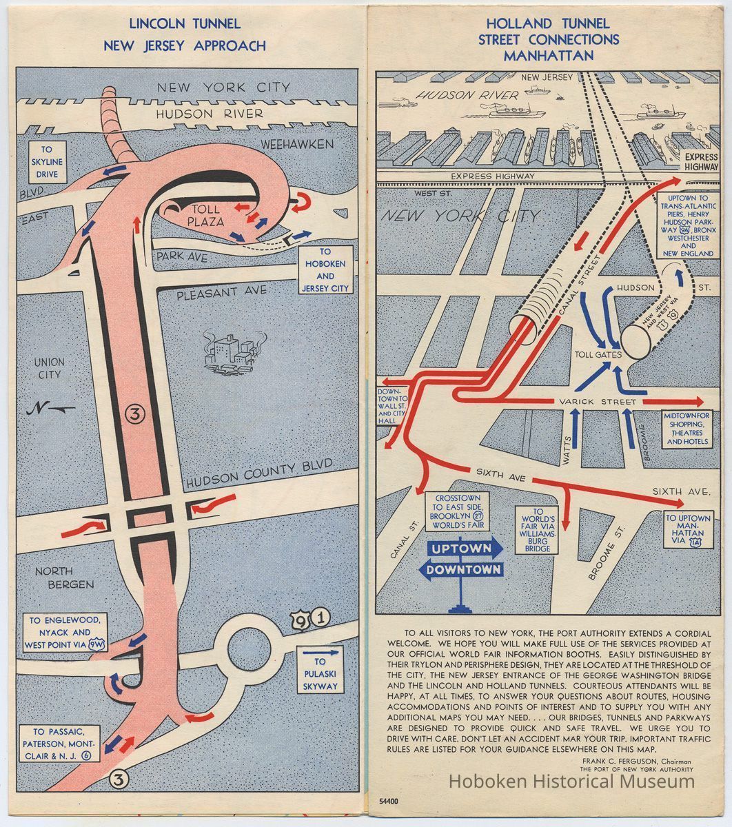
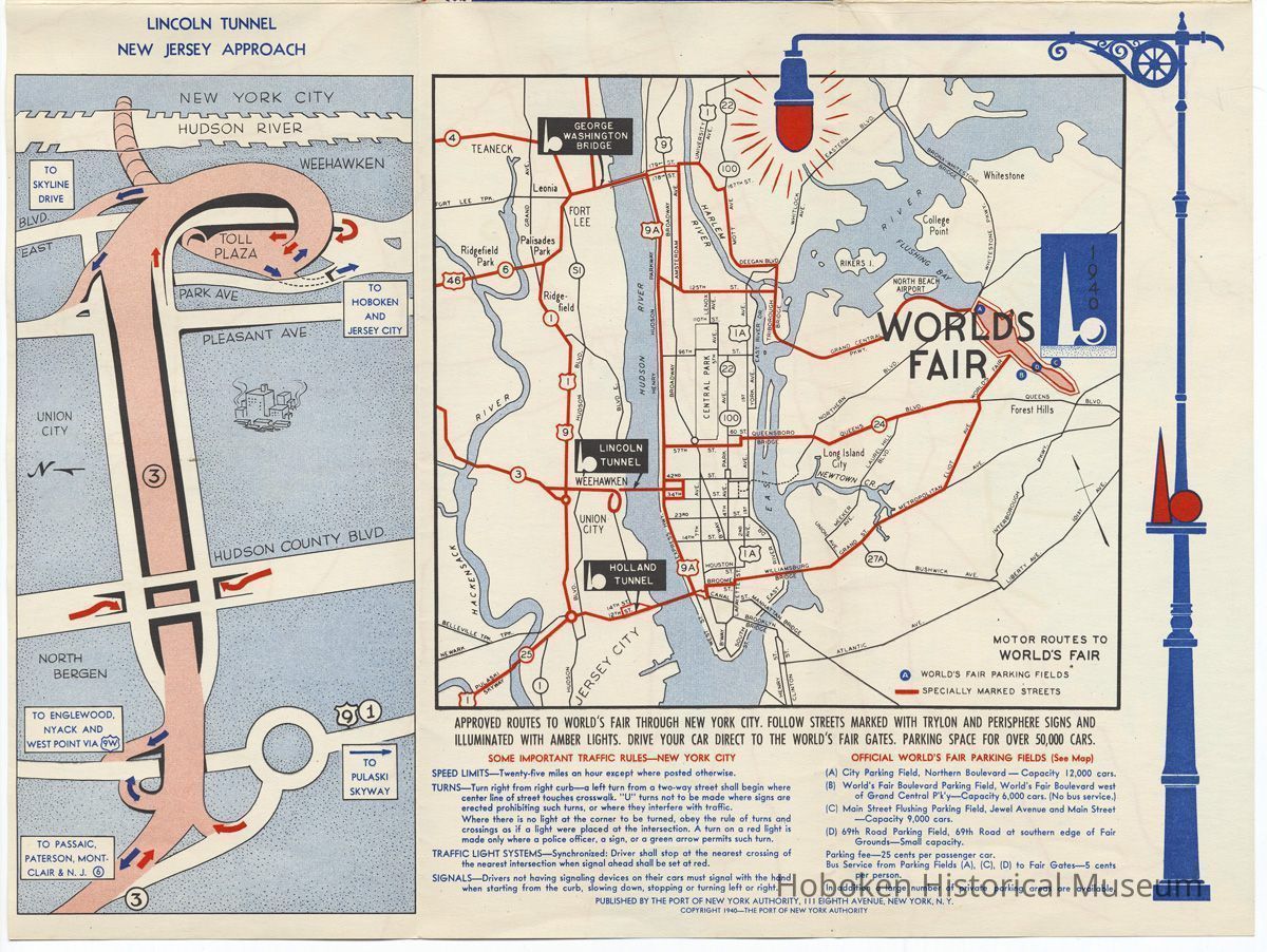
Lincoln Tunnel: Metropolitan New York. Routes to World's Fair 1940. 4 Minute Crossings. Issued by Port of N.Y. Authority, 1940.
Archive
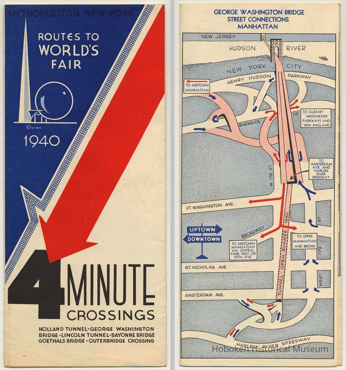
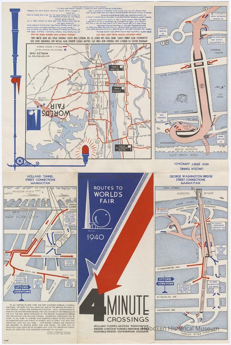
Metropolitan New York. Routes to World's Fair 1940. 4 Minute Crossings. Holland Tunnel - George Washington Bridge - Lincoln Tunnel - Bayonne Bridge - Goethals Bridge - Outerbridge Crossing. Published by the Port of New York Authority, copyright 1940.
Single sheet printed in color, 12" wide x 18" high folded to 4" wide x 9" high.
See archives 2011.005.0194 for a 1938 version, similar in format and differing content; issued prior to opening of the LIncoln Tunnel in late 1937.
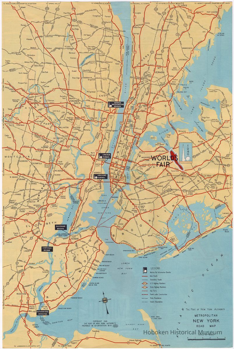
The brochure opens up to a full-sheet road map of the New York and New Jersey metropolitan area and was intended to promote New York automobile transportation in respect to water crossings such as bridges and tunnels with promotion of the second and last year of the New York World's Fair. Map is copyrighted 1940 with the site of the Fair prominently marked.
Also, the map was prepared in cooperation with the AAA (Automobile Association of America) and thus it does not include any markings for other modes of transportation such as railroads or ferries except the Staten Island Ferry.
The four minute crossing was probably intended as the travel time once your vehicle entered the tunnel or was on the bridge, not the total time including tolls or traffic back-ups..
2011.005.0241
2011.005
Lukacs, Claire
Gift
Museum Collections. Gift of a friend of the Museum.
1940 - 1940
Date(s) Created: 1940 Date(s): 1940
Good
Status: OK Status By: dw Status Date: 2011-12-05