Collections Item Detail
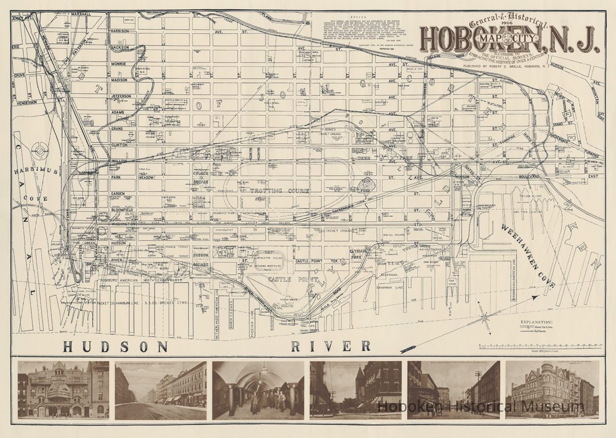
General & Historical 1906 Map of the City of Hoboken with 1989 annotations. 1998 reprint.
Archive
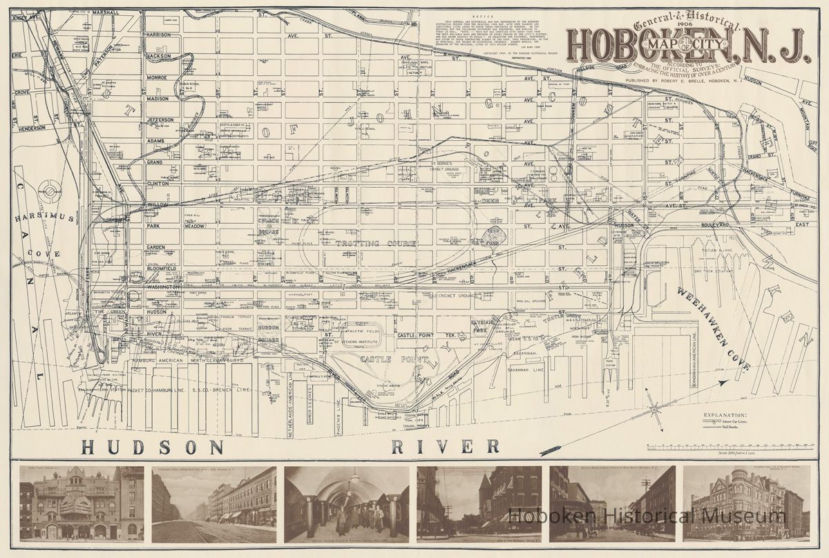
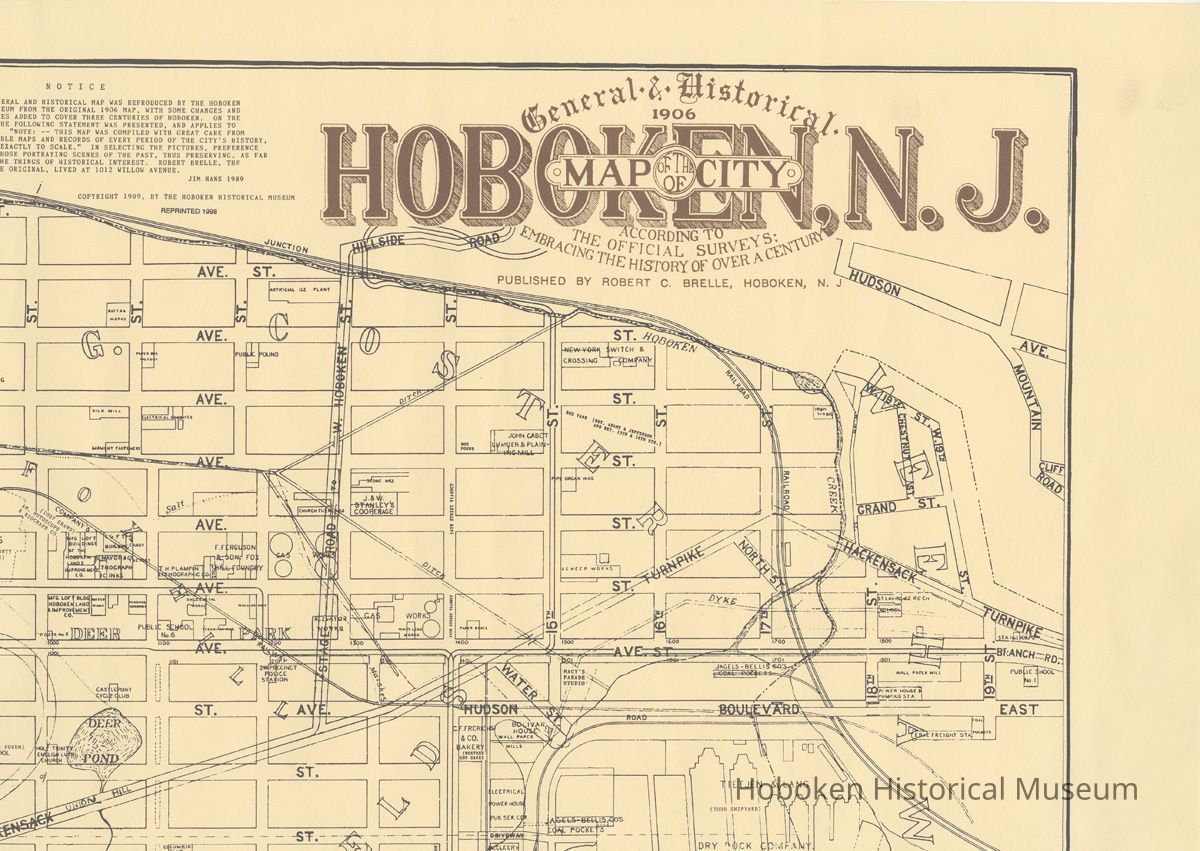
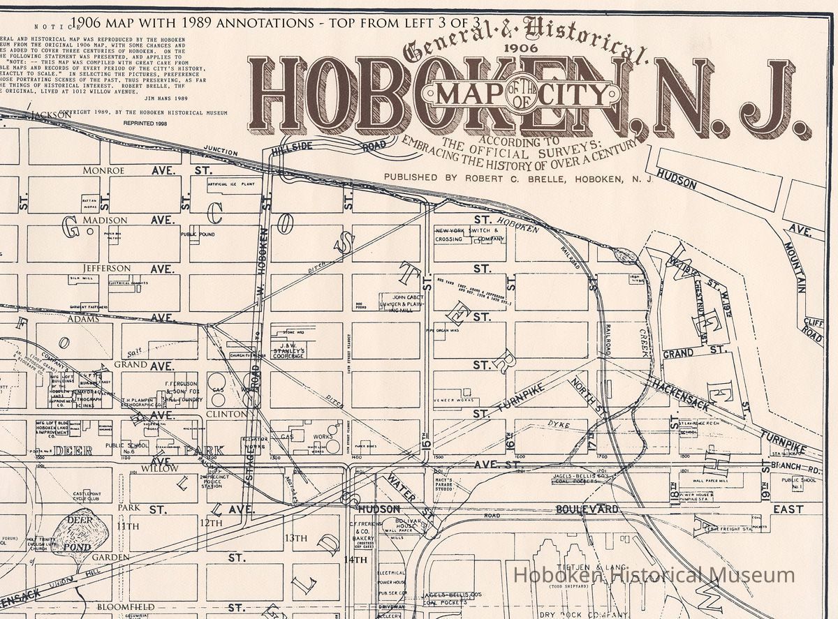
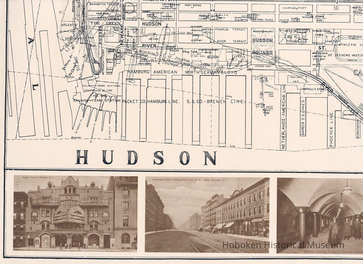
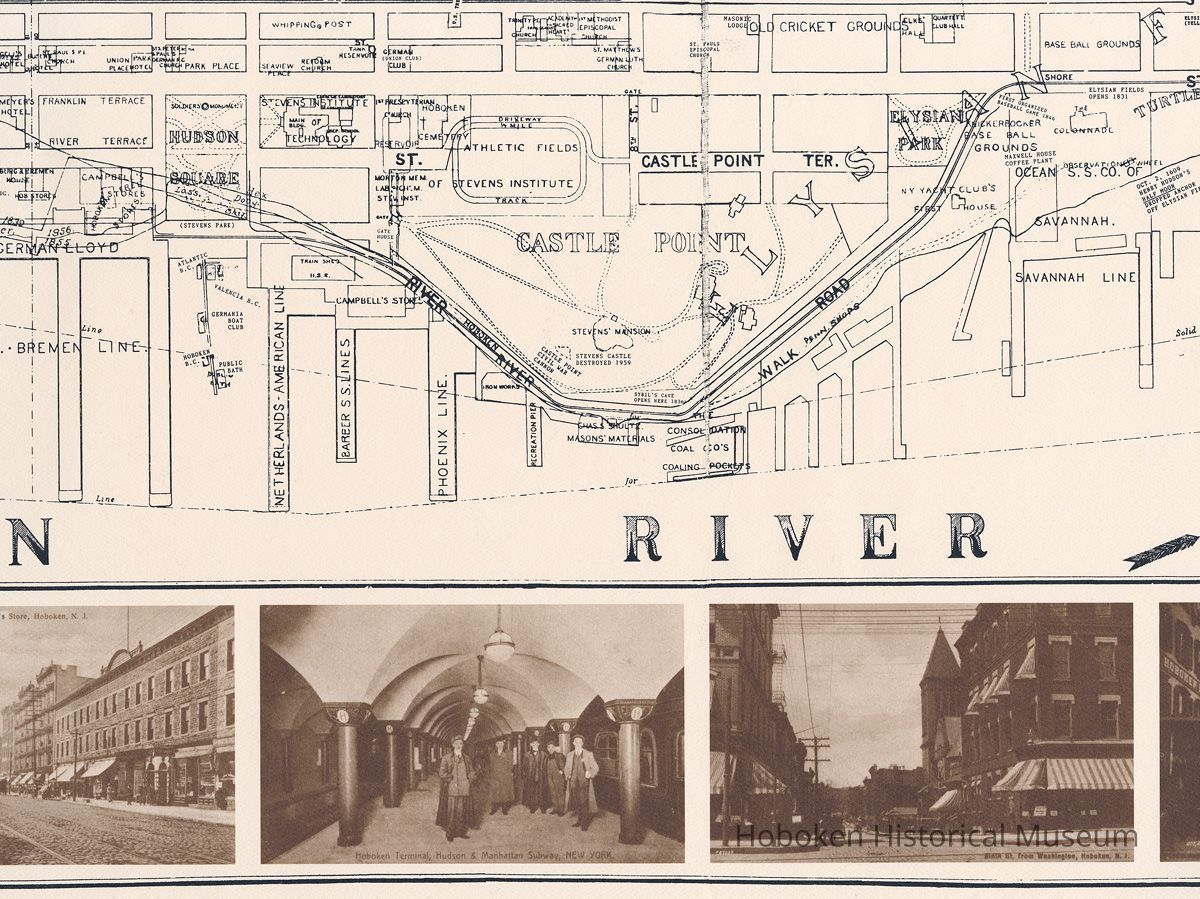
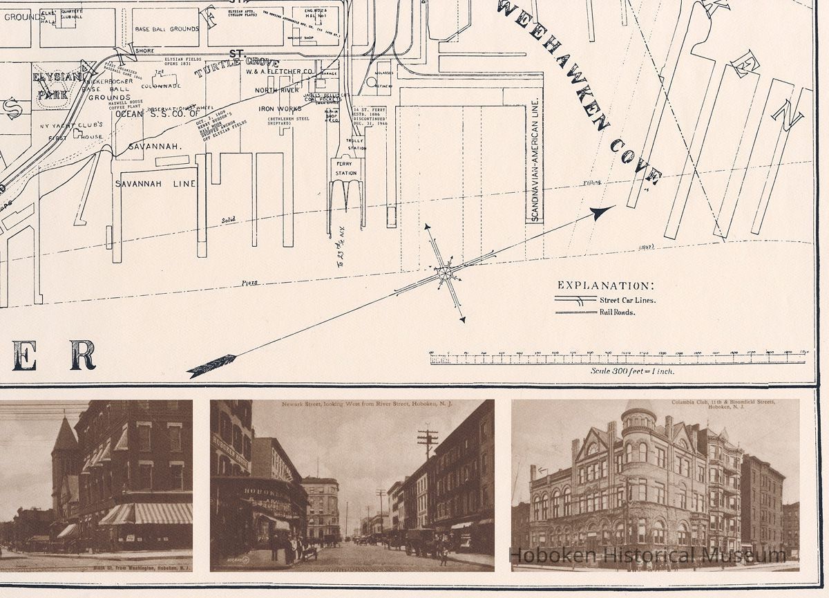
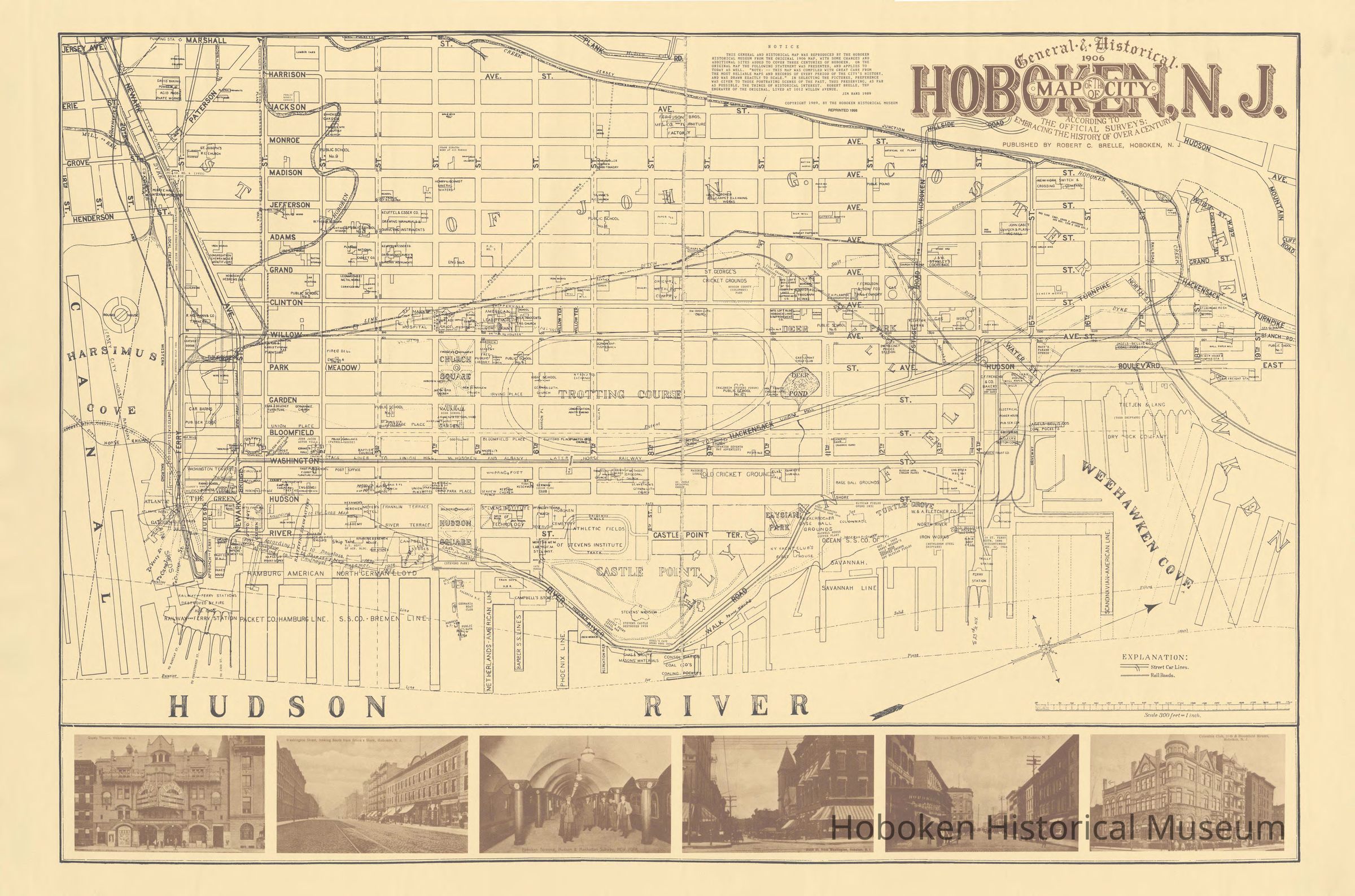
General & Historical 1906 Map of the City of Hoboken, N.J. According to the Official Surveys: Embracing the History of Over a Century. Published by Robert C. Brelle, Hoboken, N.J.
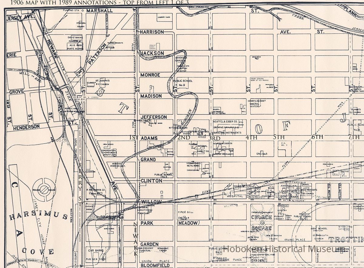
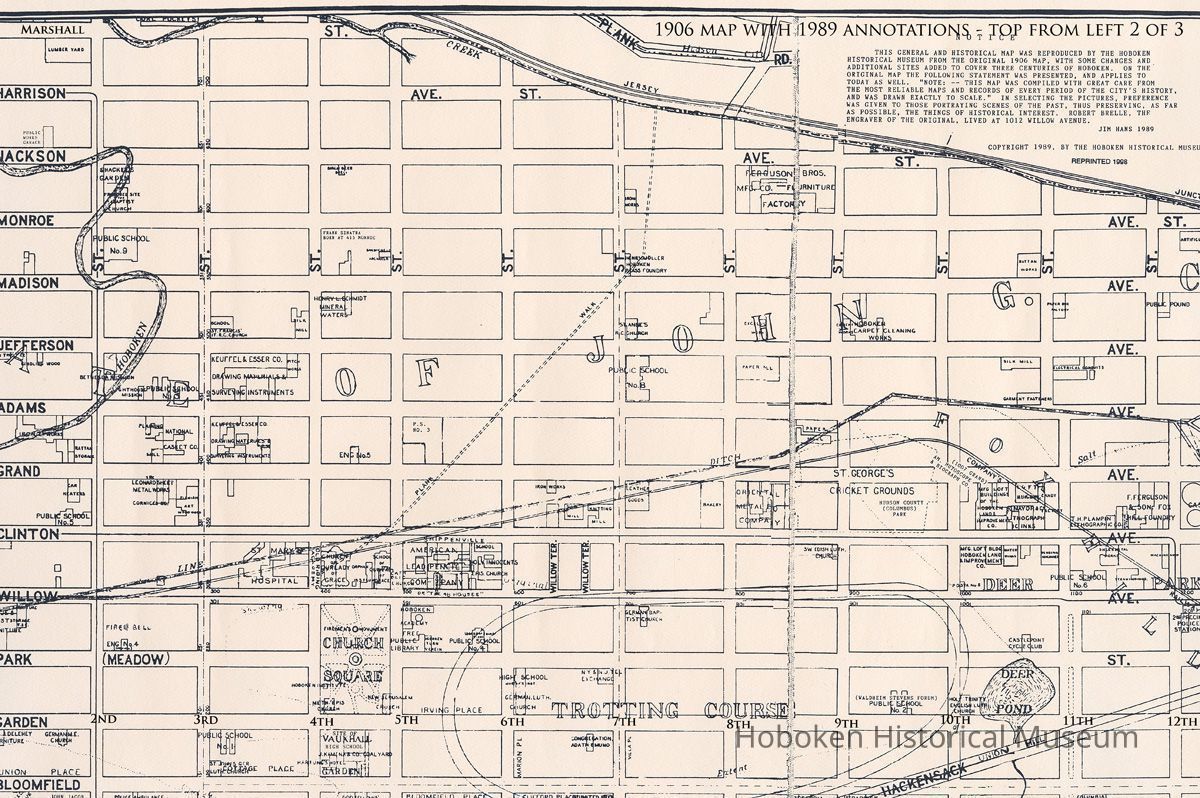
With 1989 annotations by Jim Hans, Hoboken Historical Museum.
Reprint from 1998 of 1989 issue. Printed sheet, 25" high x 38" wide (source of original not indicated; size of original not indicated.) Original scale: 300 feet = 1 inch. PDF on file. Images archived.
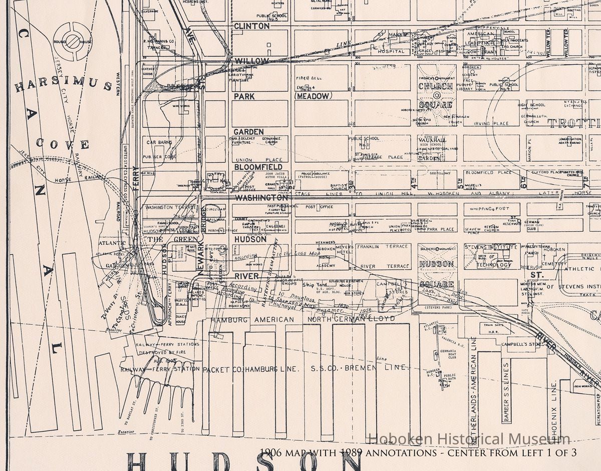
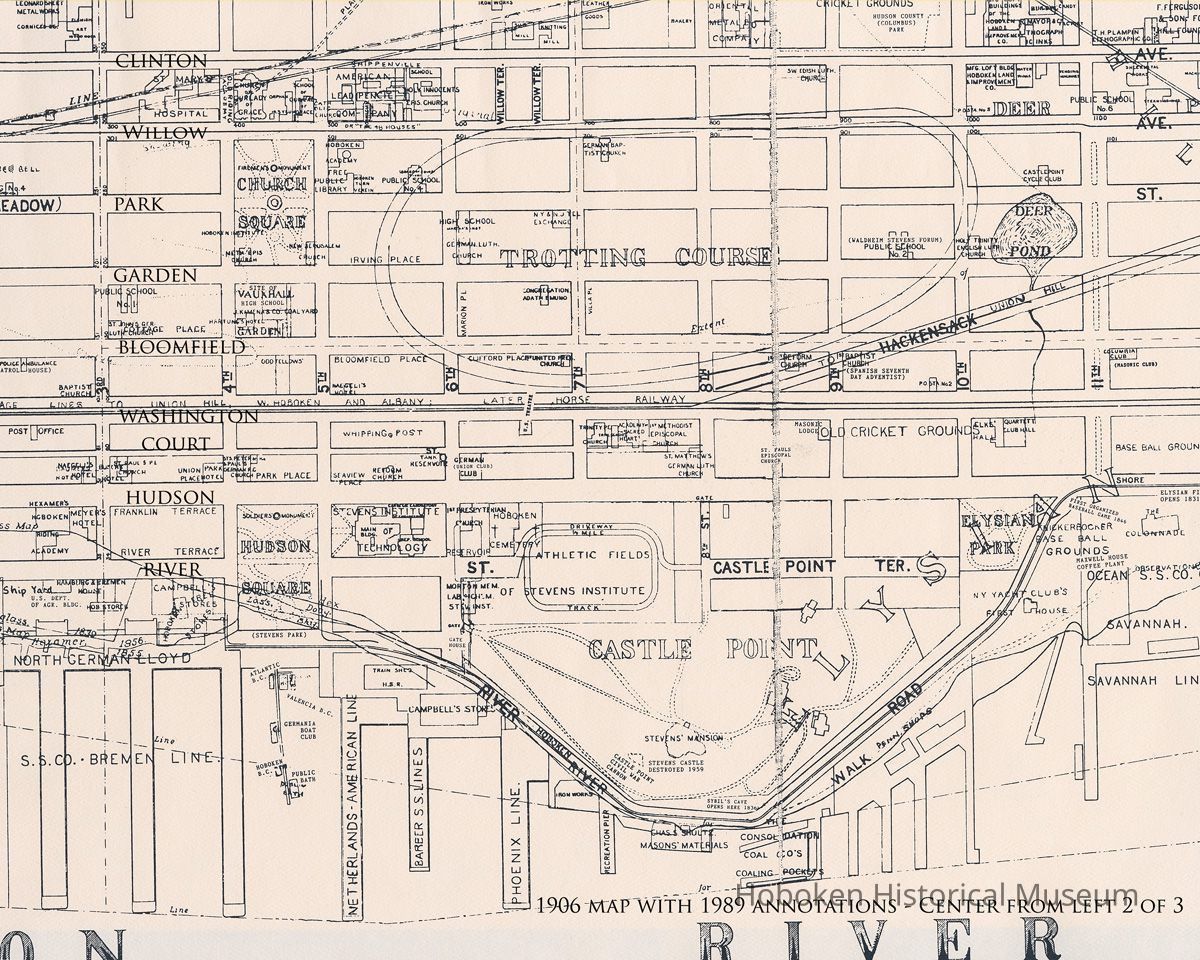
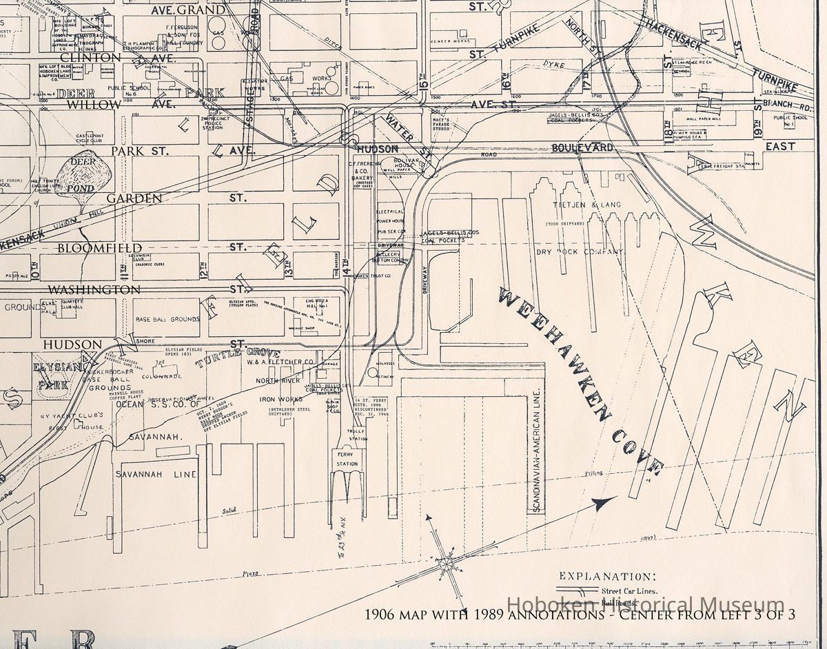
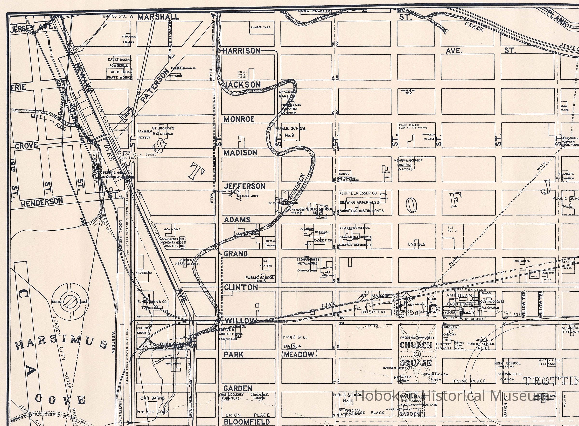
For reference purposes, it has been scanned in sections. The map is shown first with one scan of the title area in the original printed color on toned paper and the margins. It is followed by nine overlapping enhanced scans showing the entire printed piece, but without margins. Because there are six postcard views from the early 1900s added across the bottom and the wide borders, the actual map area is only 19-1/2" high x 34" wide. The map itself is seen in the first six of those nine images, three across top and center scans. They have had type added to identify their position and also street names that do not show on that section. The PDF has full map plus all sections with and without this type.
Map was reformatted by Hans so the scale is not original; it would appear that 1 inch equals circa 200 feet on this reprint.
2008.004.0012
2008.004
Found in collection
Found in Collection
Museum Collections.
1906 - 1989
Date(s) Created: 1906,1989 Date(s): 1906-1989
Notes: Images archived as TIFFs as scanned (unadjusted and uncropped) as well as cropped and adjusted. Status: OK Status By: dw Status Date: 2008-02-15