Collections Item Detail
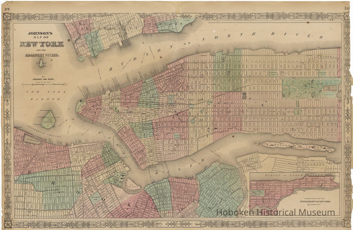
Johnson's Map of New York and Adjacent Cities. Johnson and Ward, New York, circa 1863-1870.
Archive
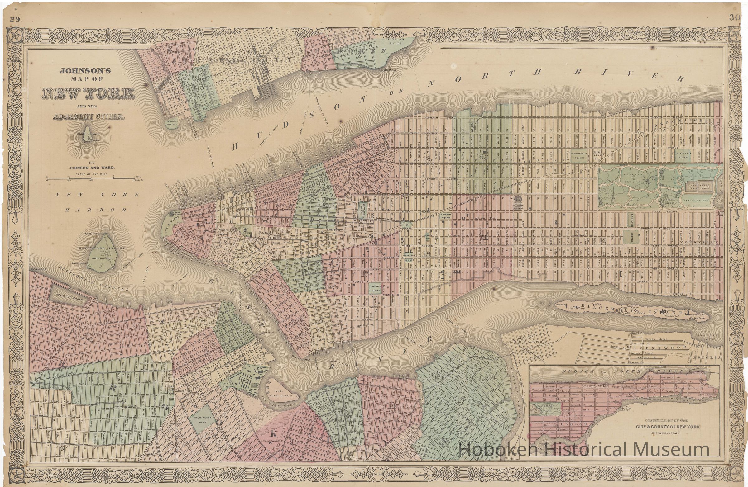
Johnson's Map of New York and Adjacent Cities. Hand-colored double page map from an early edition of Johnson's New Illustrated Family Atlas. Published by Johnson and Ward, New York, no date, circa 1863-1870.
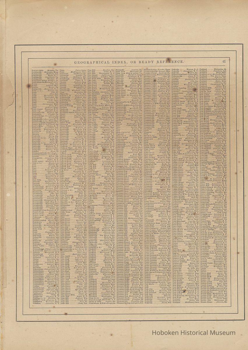
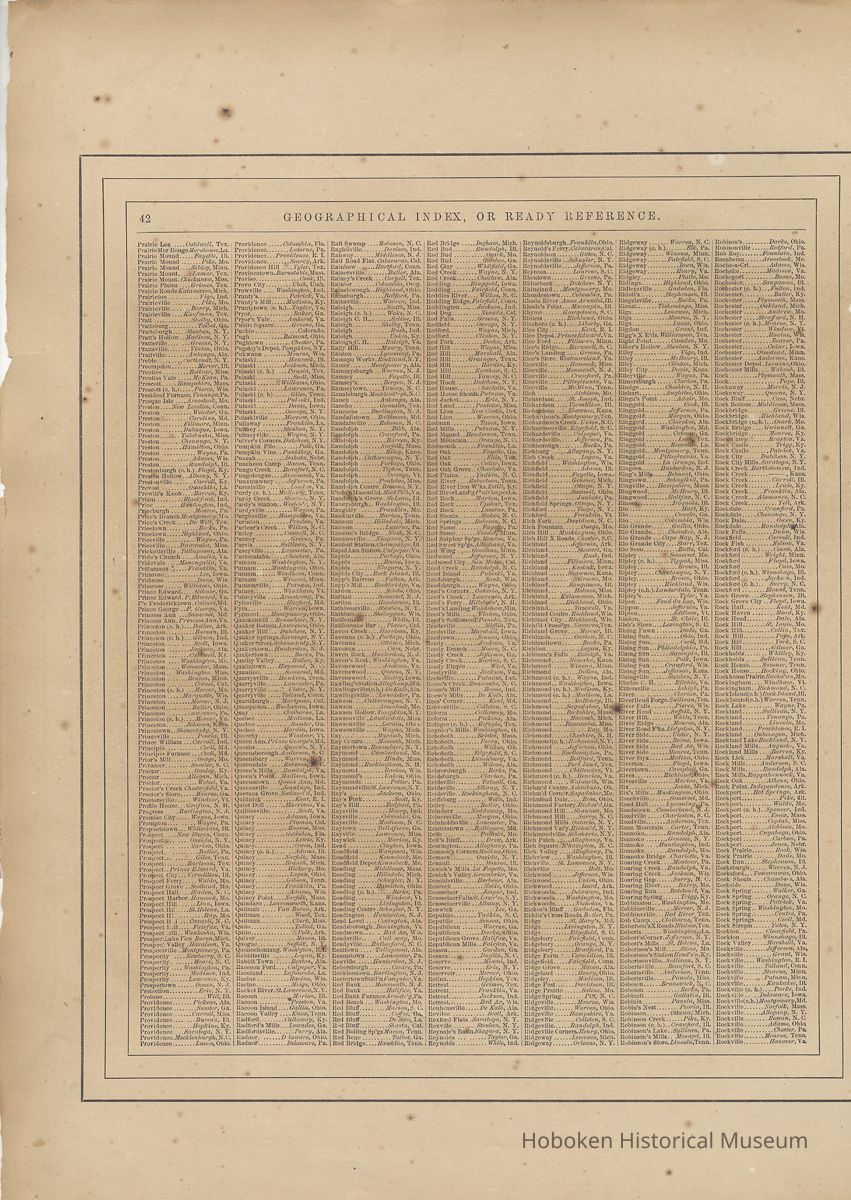
Map has plate numbers 29-30; reverse has "Geographical Index, or Ready Reference" pages 41-42. Sheet size: 18" high x 26-3/8" wide; map: 16" x 25-3/4." Scale: ca. 3-3/32" = 1 mile. PDF on file. TIFFs media archive.
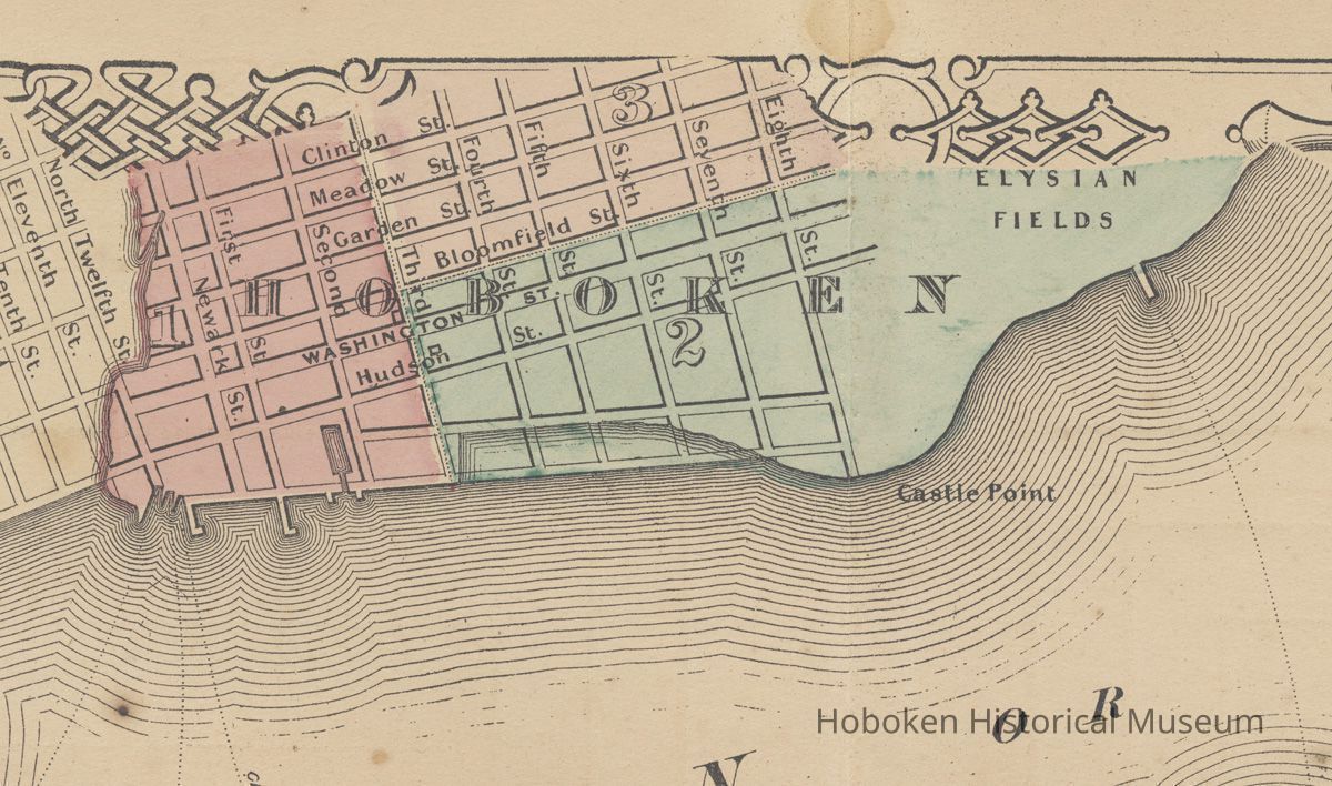
See notes for background. Across the Hudson or North River, Hoboken is partially seen at the top up to Clinton Street on the west and Eighth Street to the north with Elysian Fields beyond it. Jersey City is also partially seen.
At the bottom right is an inset map: "Continuation of the City & County of New York on a reduced scale."
The geographical index on pp. 41-42 covers from "Perkin's Mills" to "Rockville."
2008.045.0001
2008.045
Finnerty, Peg
Gift
Gift of Peg Finnerty
1862 - 1870
Date(s) Created: 1863-1870 Date(s): 1863-1870
Good
Notes: The map was originally created by J.H. [Joseph Hutchins] Colton ca. 1856 (note the Crystal Palace at 42nd and Sixth Avenue in New York; it was present in 1856, but burned down in 1858.) A.J. [Alvin Jewitt] Johnson obtained Colton's plates and published them under Johnson & Browning in 1860 "as successors to J.H. Colton." Editions from 1862 to 1865 were published by Johnson and Ward. The map here with the interlaced strapwork border with star corner bosses is no earlier than 1862. The leaf size is larger than several page size descriptions recorded for this map. Status: OK Status By: dw Status Date: 2008-05-15