Collections Item Detail
Harrison's Map of Jersey City and Hoboken, Hudson County, N.J., 1894.
Archive
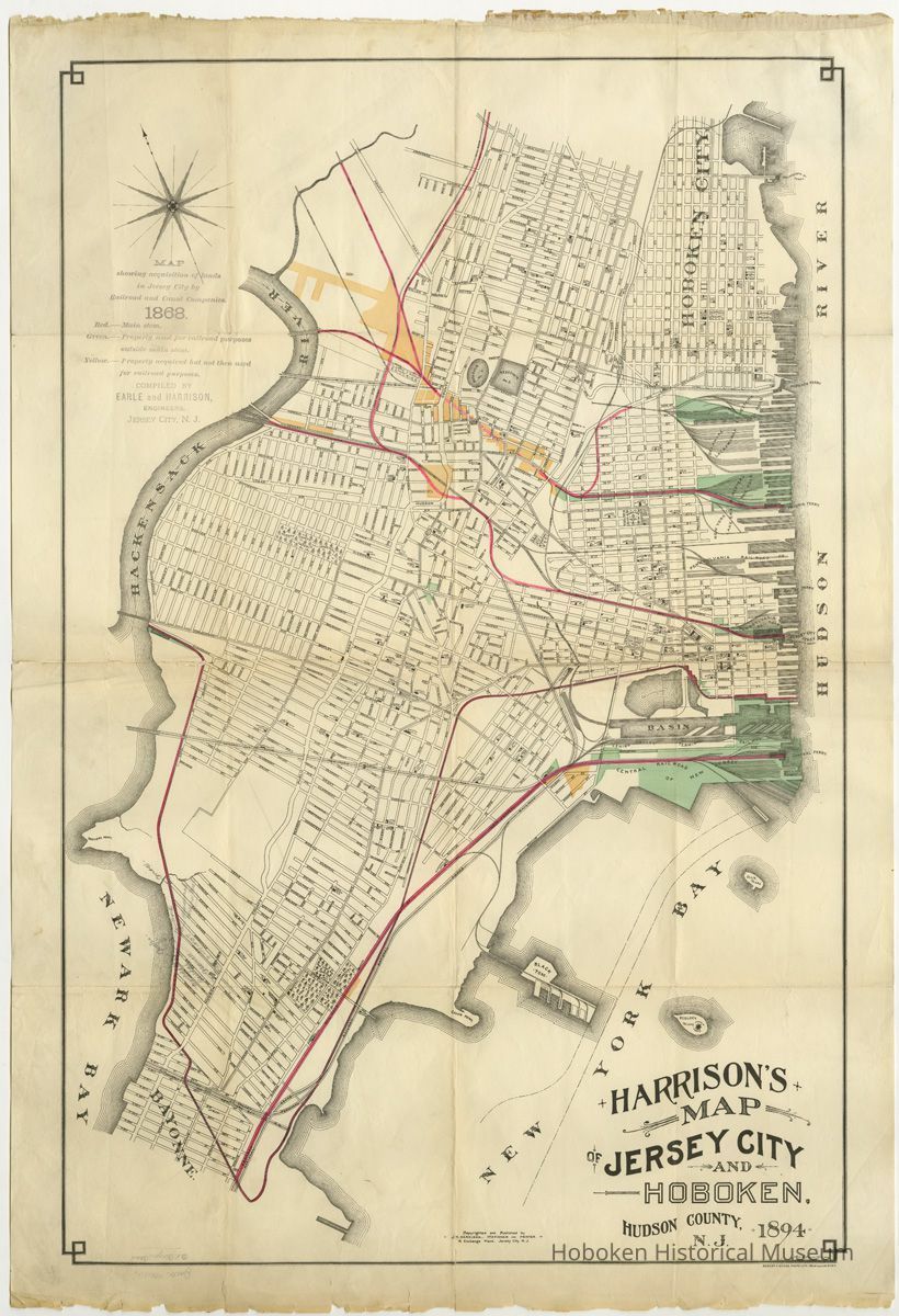
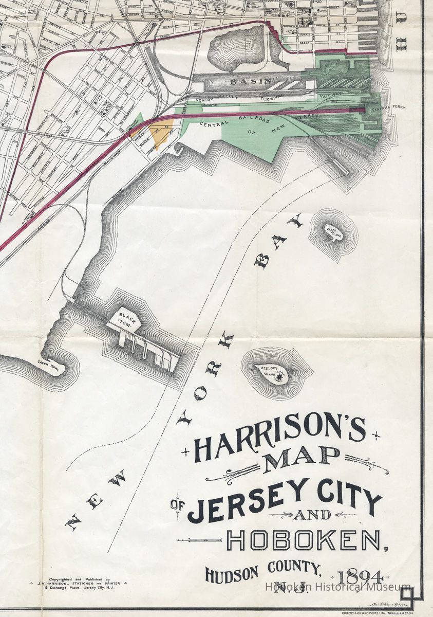
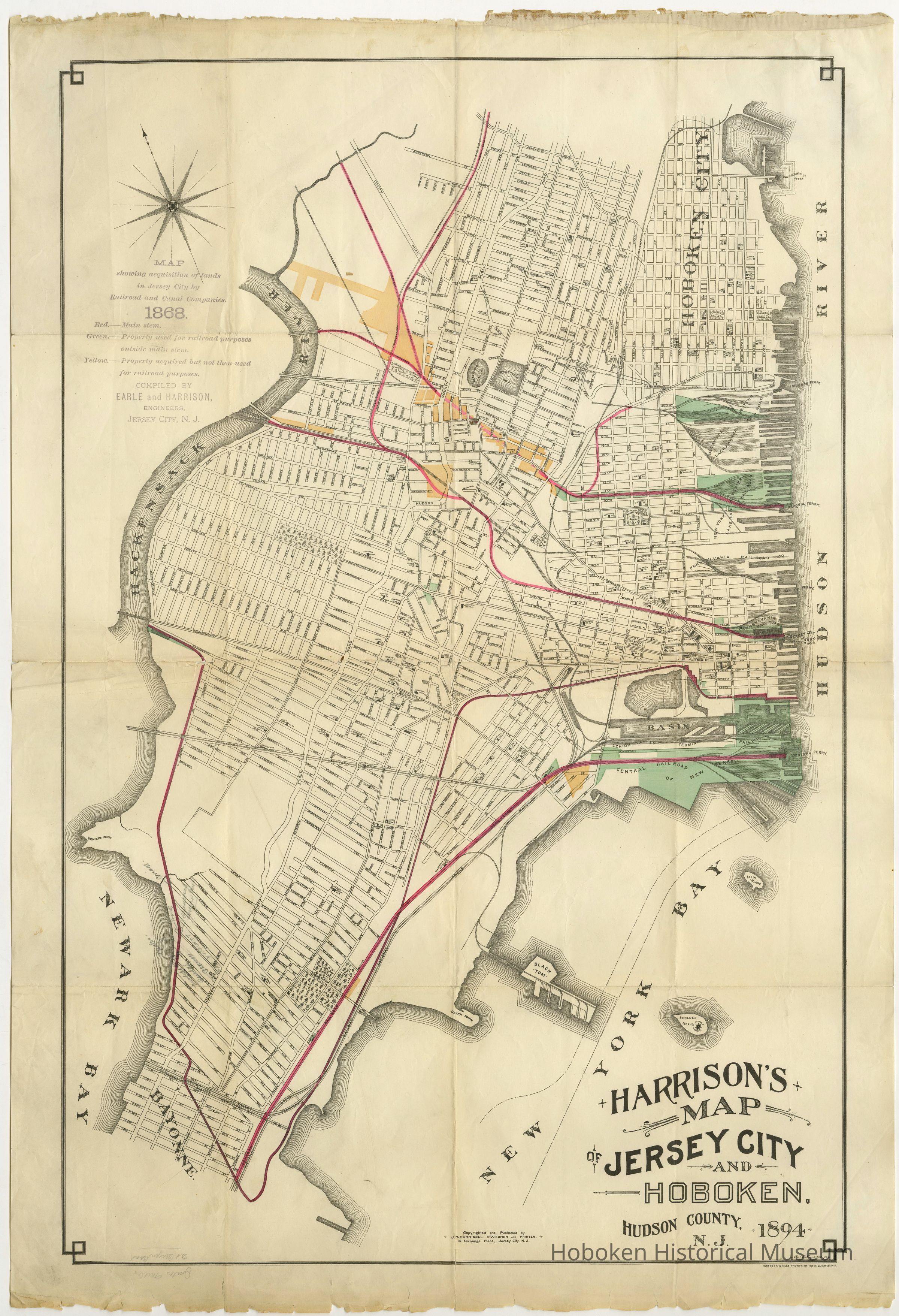
Harrison's Map of Jersey City and Hoboken, Hudson County, N.J., 1894. Copyrighted and published by J. W. Harrison, Stationer and Printer, 16 Exchange Place, Jersey City, N.J.
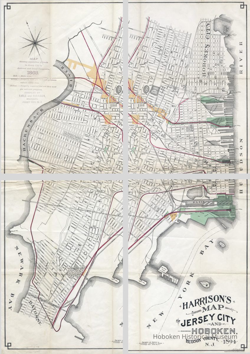
Printed paper 24" x 36" high with creases where folded to 6" x 9". No scale stated or indicated. Detail images of Hoboken, the map in overlapping quarter sections (with finding aid) and top legend are attached. PDF on file. Tiffs archived.
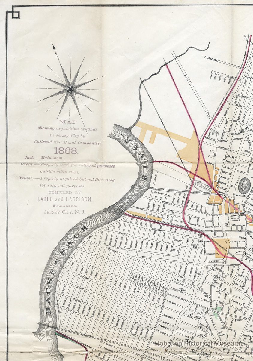
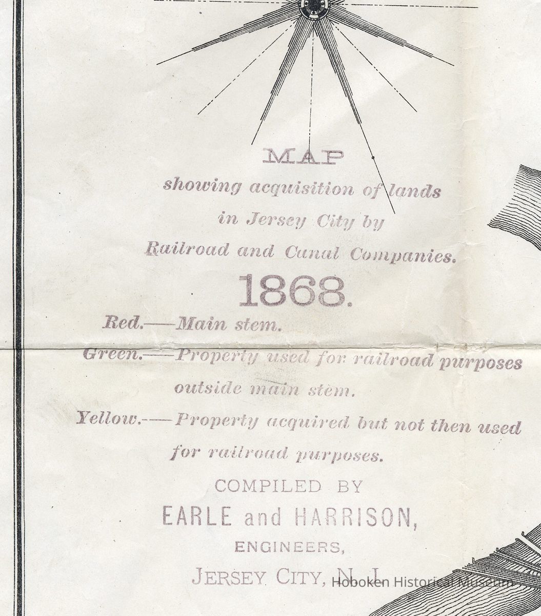
Legend at top left: Map showing acquisition of lands in Jersey City by Railroad and Canal Companies, 1868. Red - main stem; Green - property used for railroad purposes outside main stem; Yellow - property acquired but not then used for railroad purposes. Compiled by Earle and Harrison, Engineers, Jersey City, N.J.
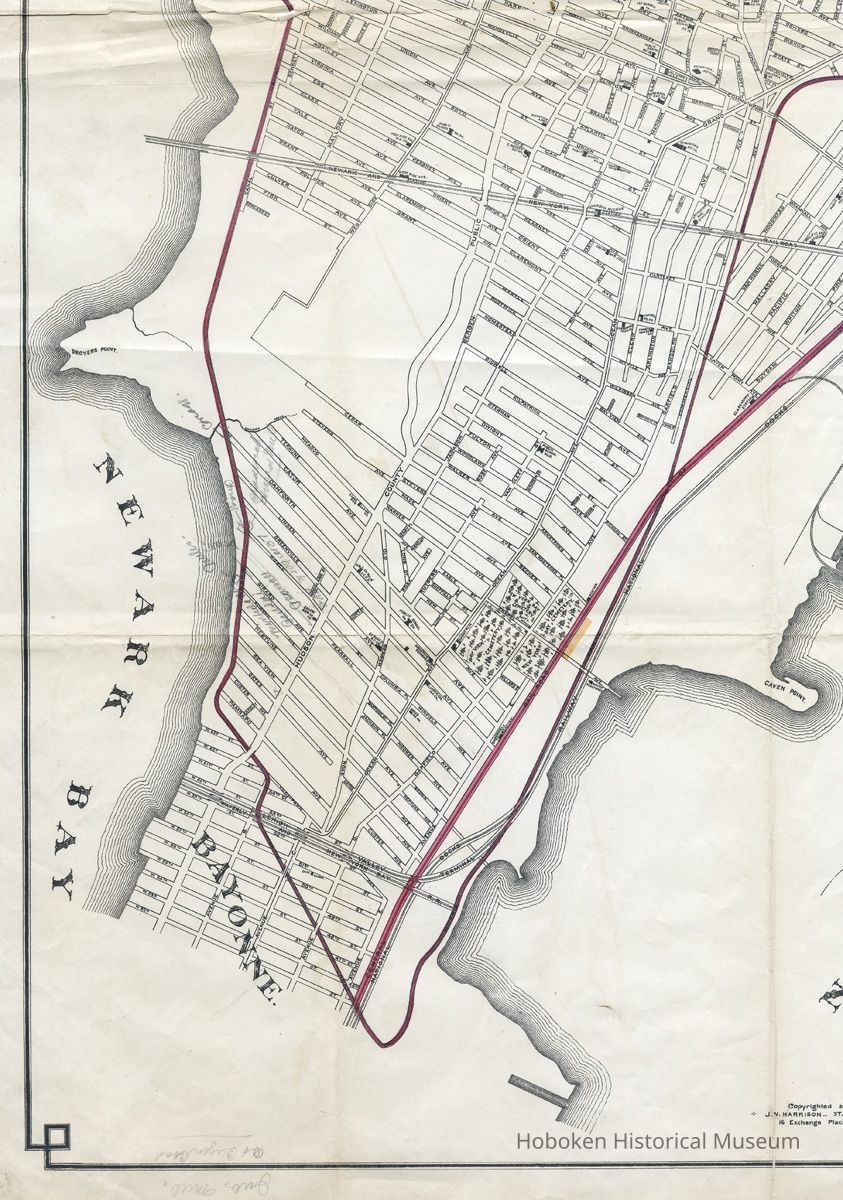
The map does name the companies and also shows the locations of ferries. Ellis Island and Bedloe's Island (with the Statue of Liberty identified) are also seen. There are some pencil annotations (probably modern) of street names at the Jersey City - Bayonne border.
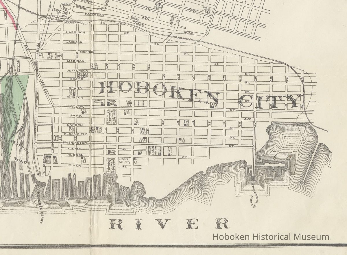
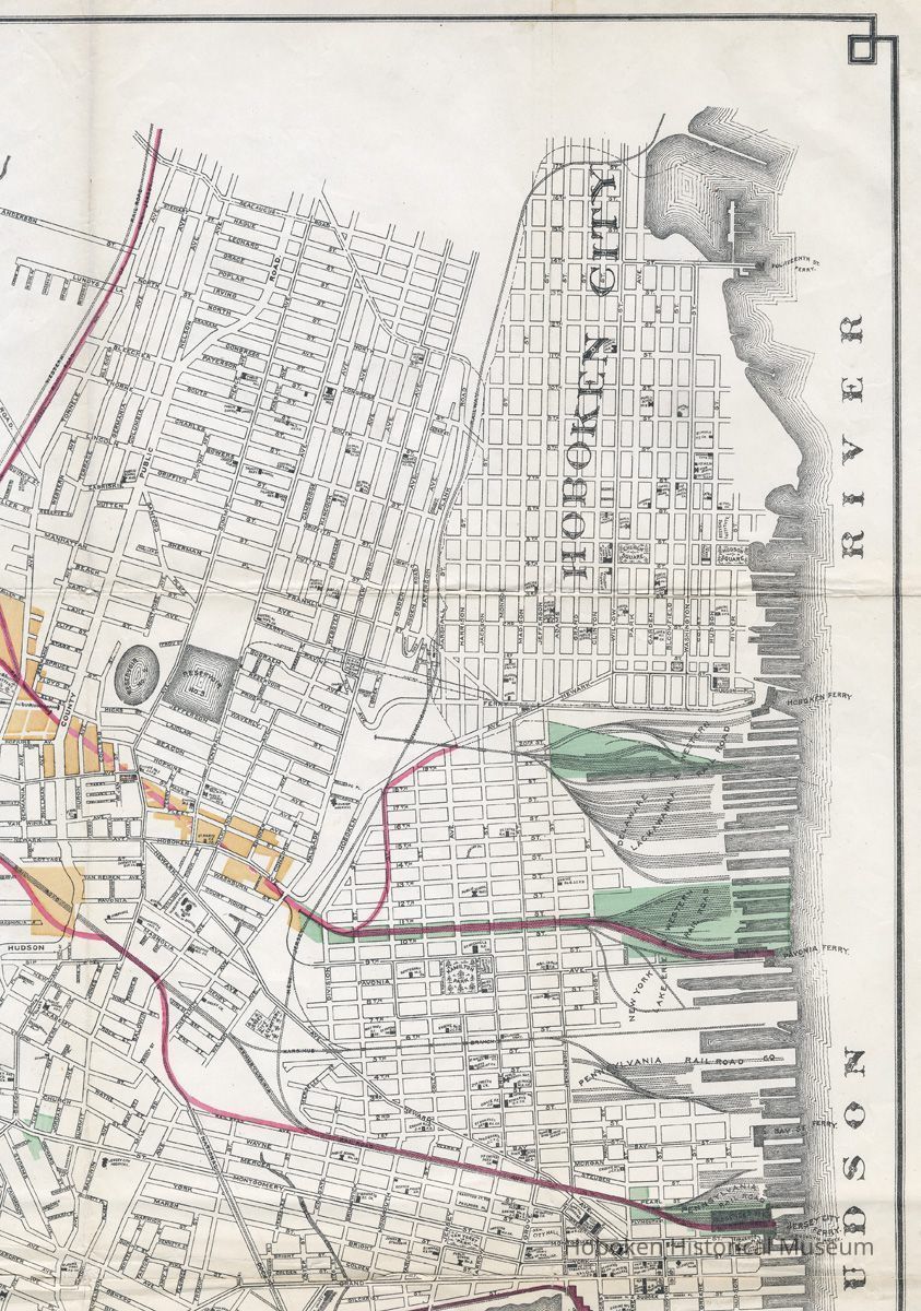
Hoboken has buildings named and sited as would be found about 1890 including City Hall, parks, hospital, schools, churches, firehouses, ferries, railroads, horsecar lines, banks and Stevens Institute. Not current is the detail of the northern waterfront which shows Hudson Street ending at 11th Street. The W.& A. Fletcher Company had established itself at 13th and Hudson in 1890 and other businesses would have extended along Hudson St. up to Fourteenth Street where the ferry is shown. Elysian Fields is not identified.
2008.041.0001
2008.041
Purchase
Purchase
Museum Purchase.
1868 - 1894
Date(s) Created: 1894 Date(s): 1868-1894
Fair
Status: OK Status By: dw Status Date: 2008-05-02